Europe · United Kingdom · England / Wales / Scotland; itinerary base: the English Lake District · HAPPY TOGETHER TRIPS
United Kingdom: 10 scenic hikes, with 4- and 6-day Lake District plans
Lake reflections, glacial basins, Scottish pinnacles and chalk cliffs make a varied country collection. These ten are editorial choices, not an official or social-platform ranking. The first four are in England’s Lake District; the remaining six are alternatives for separate regional trips. Both practical itineraries stay around Windermere, with time for transport, gentle walks and weather changes.
Checked 23 October 2026. Times are suggested local planning times, not reservations. Climate is not a forecast.
Activities and official booking checks
1 · Orrest Head | English Lake District
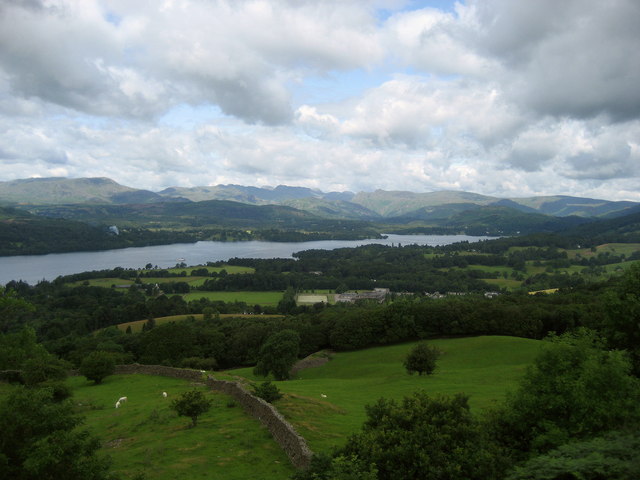
View northwest from Orrest Head toward Windermere and the central fells, July 2009; archival location photograph, not a guided-tour photograph. · Chris Heaton · Photo source · CC BY-SA 2.0 Wikimedia image downloaded unchanged; responsive display and homepage crops retain original licence.
Variant: 4.3 km circuit from Windermere, 152 m cumulative ascent; allow 1.5–2 hours. Relatively gentle, but uneven ground and stiles remain. Prefer May–June or September, with favourable April–October days possible. Walk from Windermere station; no trail admission or individual reservation is listed. The official 3.5 km accessible return route is a different variant. The official listing remained available at checking, without a live whole-route status. Watch wet roots and mud and leash dogs near livestock. Map/ascent: WalkLakes 192.
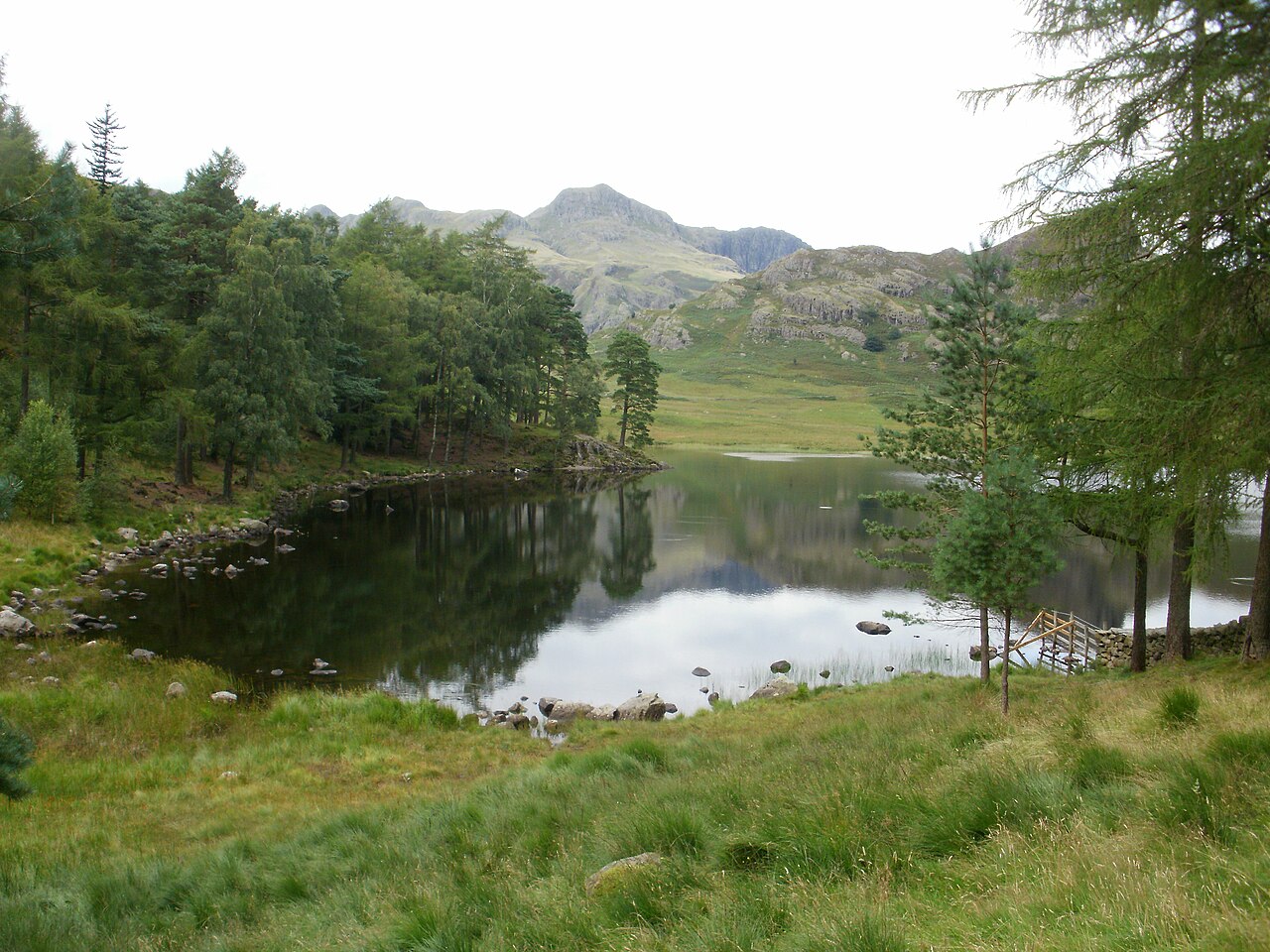
Blea Tarn and the Langdale Pikes, August 2010; archival location photograph, not a tour-package photograph. · Peter S · Photo source · CC BY-SA 2.0 Wikimedia image downloaded unchanged; responsive display and homepage crops retain original licence.
Variant: 3.0 km circuit from Blea Tarn car park, grid NY295043, with 81 m ascent; allow 1–1.5 hours. Easy grading still includes gravel, gates and brief road walking. Prefer settled May–September days. Reserve a return taxi; drivers use the paid National Trust car park, not narrow steep roadside verges. No personal hiking permit/reservation is listed; check posted parking charges. The official route remained listed, not a guarantee against same-day flooding or repairs. Give livestock space, watch traffic and do not treat the tarn as an included swim. Map/ascent: WalkLakes 139.
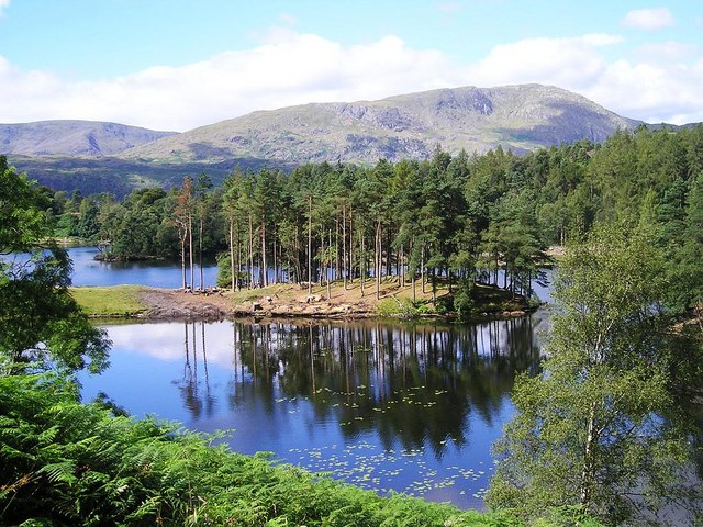
Tarn Hows, August 2005; archival location photograph, not a current-condition report. · Richard C · Photo source · CC BY-SA 2.0 Wikimedia image downloaded unchanged; responsive display and homepage crops retain original licence.
Variant: WalkLakes’ 3.1 km lakeside circuit, 66 m ascent; allow 1–1.5 hours. This gentler woodland-and-reflection walk is not completely flat: the official 3.29 km Miles without Stiles variant includes slopes up to 1:5. Prefer May–June or September; October foliage needs a separate weather check. Book a taxi to the main Tarn Hows car park; drivers pay parking, while no walking admission reservation is listed. The official page was available, not a live obstacle inventory. Check its accessibility category for mobility equipment. Do not add the steep Tom Gill extension casually. Map/ascent: WalkLakes 225.
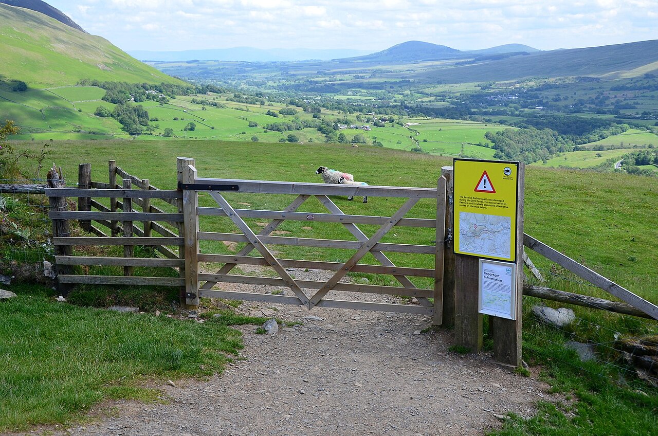
A gate and landscape on Latrigg, June 2019; location reference, not proof that every route variant is accessible. · Jim Barton · Photo source · CC BY-SA 2.0 Wikimedia image downloaded unchanged; responsive display and homepage crops retain original licence.
Variant: 2.0 km circuit with 100 m ascent from Gale Road parking, NY281254; allow 1–1.5 hours. This is not the longer ascent from Keswick town. Gravel and grass make it easy-to-moderate, with exposure to wind. Prefer May–September. From Keswick book a taxi both ways; limited parking is neither guaranteed nor assumed free. No individual trail permit/reservation is listed. Official short-route information remained available. The grassy circuit is not the accessible return variant: check the official version for mobility aids. Cancel for strong wind or low cloud and watch wet grass and sheep. Map/ascent: WalkLakes 12.
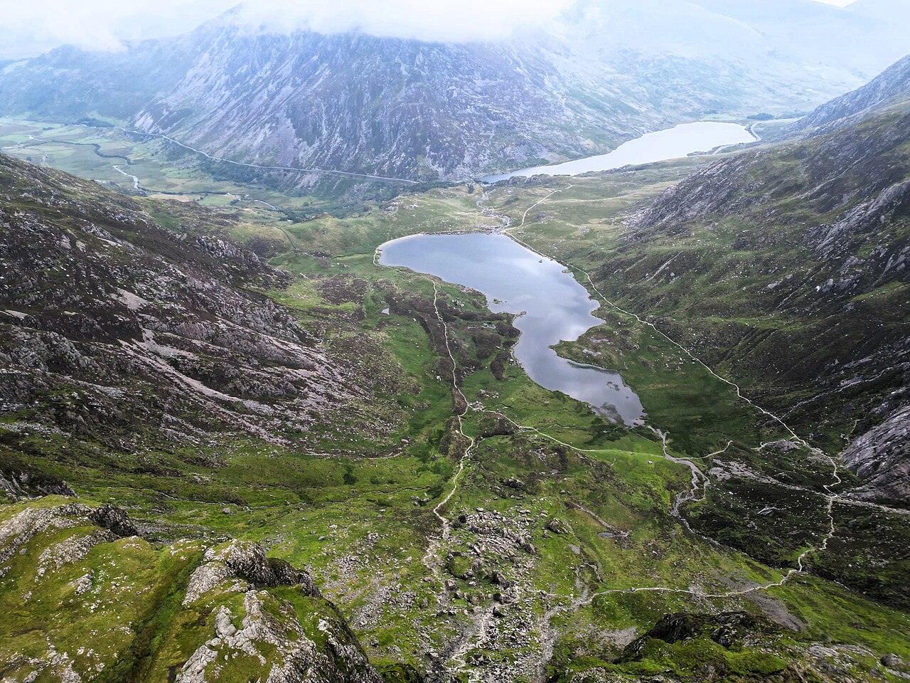
Aerial view of Cwm Idwal, July 2023; landscape reference, not a drone activity included in this walking guide. · Llywelyn2000 · Photo source · CC BY-SA 4.0 Wikimedia image downloaded unchanged; responsive display and homepage crops retain original licence.
Official variant: 5 km circuit, 140 m ascent, about two hours, moderate. It includes steeper loose-rock ground towards Devil’s Kitchen: not just a flat lakeside stroll, and not an ascent of Twll Du. Prefer settled, snow-free May–September conditions. Start at Canolfan Ogwen; check T10 to Llyn Ogwen or seasonal Bws Ogwen connections. Official parking was £6/day or £3/four hours, card/contactless; no individual trail reservation was listed. The route was published at checking, without a real-time whole-route guarantee. Use grippy footwear and the official offline map; avoid climbing lines, ice and flooded sections.
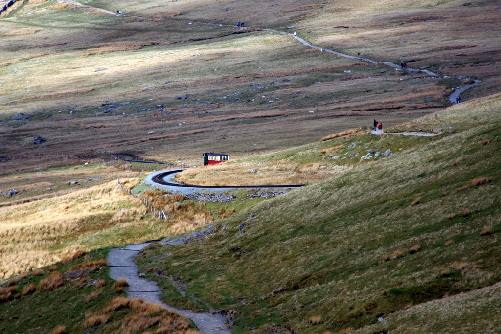
Llanberis Path beside the Snowdon Mountain Railway, April 2011; location reference only. Walkers must stay off railway tracks; no train ride is included. · Christine Matthews · Photo source · CC BY-SA 2.0 Wikimedia image downloaded unchanged; responsive display and homepage crops retain original licence.
Official return hike: 14.5 km, 975 m ascent, about seven hours, hard/strenuous. A gradual gradient still demands fitness, navigation and full hill gear. Prefer snow-free May–September days with low wind and visibility. Start/end at the far end of Victoria Terrace, Llanberis; use Sherpa’r Wyddfa buses to Llanberis Interchange or legal village parking. No individual summit walking ticket/reservation is listed. The separately ticketed railway is not a descent-rescue plan; walking on its tracks is prohibited. The route remained listed; check Yr Wyddfa Live for actual ground conditions. Cancel/turn back for ice, weather or fatigue; technical winter ascent is excluded.
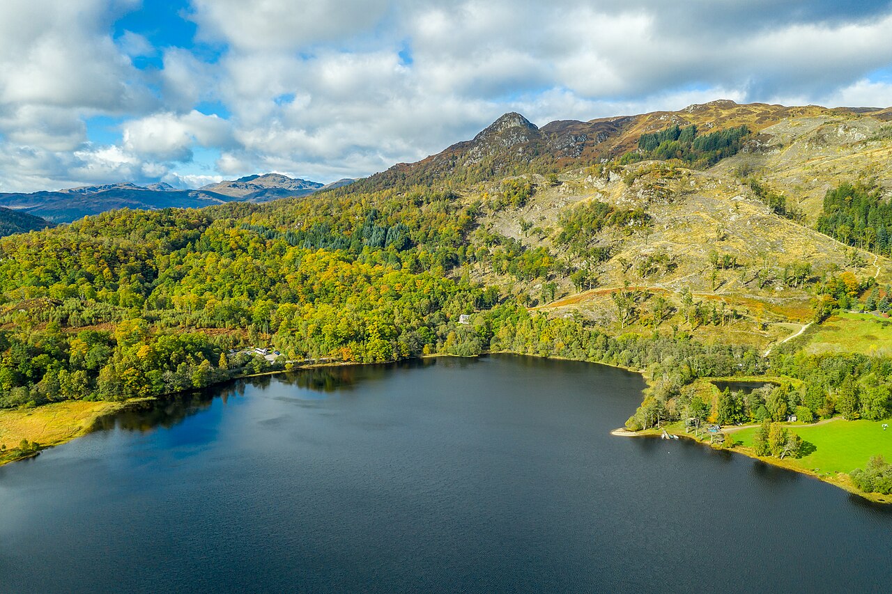
Ben A’an and the Trossachs, October 2018; autumn aerial location reference, not a summer photograph or included drone activity. · Ian Dick from Glasgow, UK · Photo source · CC BY 2.0 Wikimedia image downloaded unchanged; responsive display and homepage crops retain original licence.
Walkhighlands variant: 3.7 km out-and-back, 340 m ascent, two–four hours; the park rounds it to about 4 km. This short but steep moderate hill walk has rocky upper ground. Prefer settled, snow-free May–September days. Start at paid A821 parking, NN509070. Check whether the seasonal Trossachs Explorer operates, its stop and last service; do not assume year-round buses. No individual walking permit/reservation is listed. The park still listed the route and reminded walkers about land operations/deer management; follow temporary signs. Avoid wet-rock, wind or ice summit conditions and return by the same path, without climbing adjacent crags. Summit altitude, 454 m, is not the ascent.
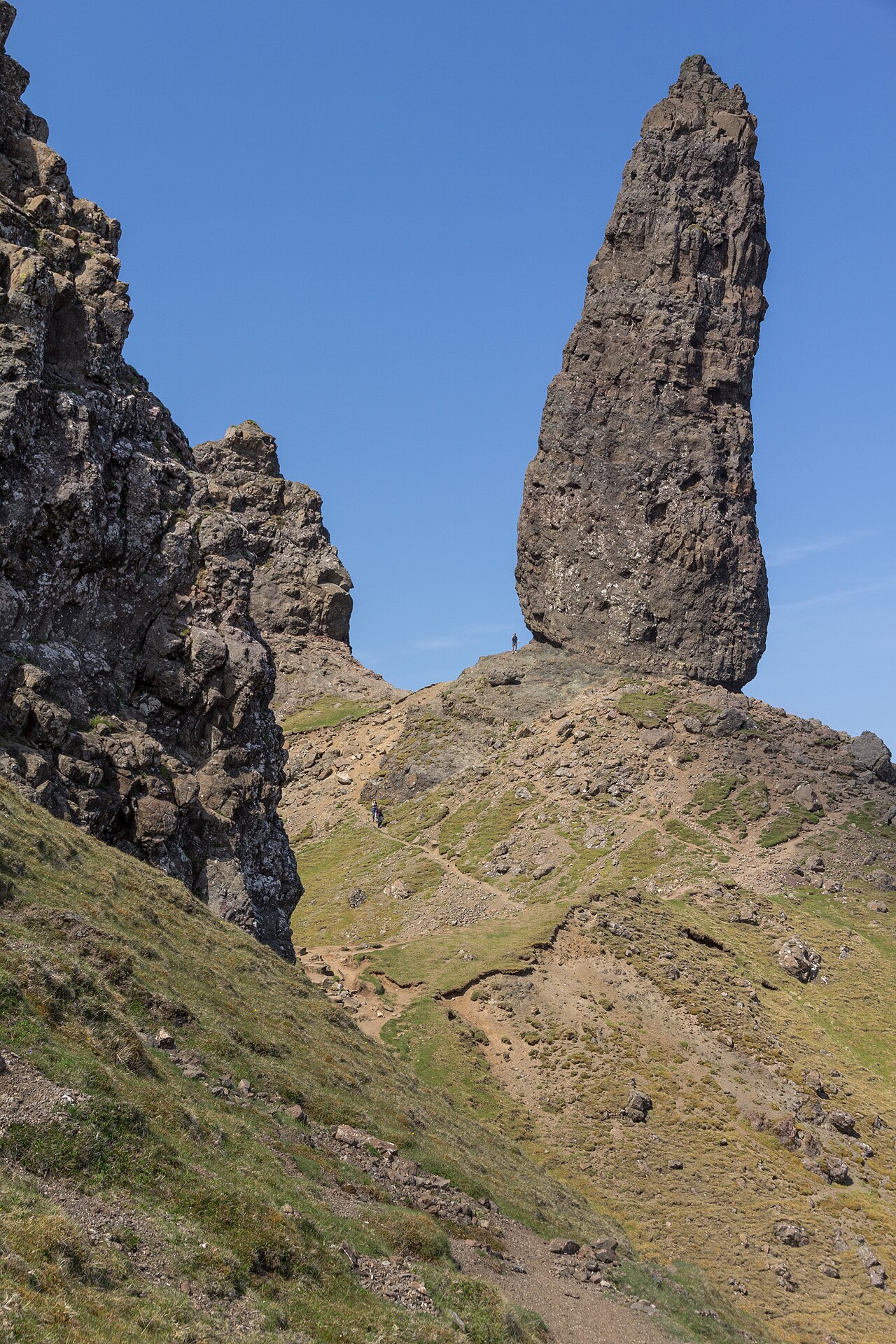
Old Man of Storr pinnacles, June 2013; location reference, not permission to approach unstable rock faces. · JoachimKohlerBremen · Photo source · CC BY-SA 4.0 Wikimedia image downloaded unchanged; responsive display and homepage crops retain original licence.
Walkhighlands’ pinnacle route is 5 km with 340 m ascent: return approach plus an upper circuit, not the Storr summit route. Walking time is 1.5–2 hours; allow two–three with stops. Moderate, steep and rocky; prefer settled May–September days. Use paid A855 parking, NG508528, or check the Portree–Storr bus; toilet hours vary. No personal hiking reservation is listed; parking/facility charges are local. The route remained published, but the source warns of rockfall, particularly after heavy rain. Avoid the eroded direct line beneath the Cathedral and never approach cliff bases for photographs. Follow maintained paths and cancel for poor visibility, high winds or rockfall notices. The local tourism page’s shorter 3.8 km variant does not share these 5 km statistics.
9 · Mam Tor and Hollins Cross | Peak District, England
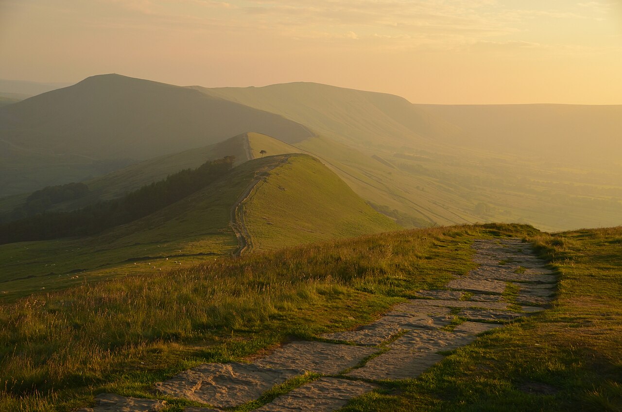
Mam Tor ridge viewed from Lose Hill, June 2018; wider landscape reference. Lose Hill is outside the selected Mam Nick circuit. · Andrew Tryon · Photo source · CC BY-SA 2.0 Wikimedia image downloaded unchanged; responsive display and homepage crops retain original licence.
Walking Britain’s Mam Nick circuit is 4.9 km with 212 m ascent, about two hours; National Trust describes a nearby 4.8 km moderate variant. Follow the ridge to Hollins Cross and return below the hill. Steps, rough ground and wind exposure rule out an easy-access label. Prefer April–June or September. Mam Nick, SK123832, has a small paid car park; a reserved taxi from Castleton is an alternative. Edale station is not this start point. No individual trail reservation is listed. Restoration notices remained relevant: obey barriers and keep off prehistoric earthworks. Postpone in high wind/low cloud. Blue John cave admission and Lose Hill are not included.
10 · Seven Sisters and Friston Forest | Sussex, England
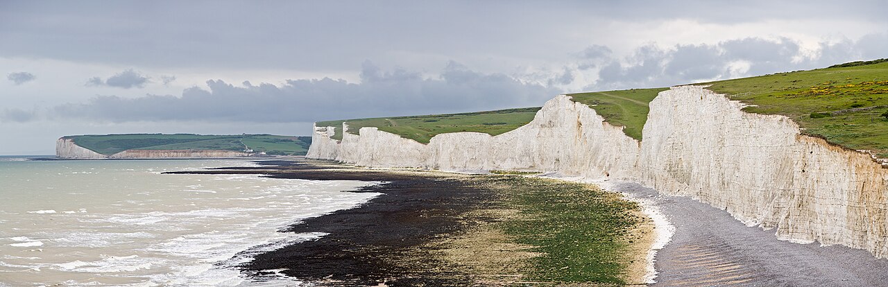
Seven Sisters coastal panorama, May 2009; landscape reference from a different viewpoint. The selected walk stays on inland and clifftop paths, not below the cliffs. · Diliff · Photo source · CC BY-SA 3.0 Wikimedia image downloaded unchanged; responsive display and homepage crops retain original licence.
Walking Britain’s circuit from Exceat north parking, TV518996, is 12.2 km with 361 m ascent, estimated 4h40; allow five–six hours with rests. Moderate woodland, grass slopes and repeated chalk-cliff climbs include A259 crossings. Prefer dry, low-wind April–June or September days. Buses stop at the visitor centre; parking is paid, with no individual walking permit/reservation listed. From 24 October 2026 the notice sets parking at 07:00–18:00, locked afterwards, and visitor centre at 10:00–16:00; recheck summer hours. No live whole-route guarantee. Keep at least five metres from cliff edge/base and respect wider barriers. Never ford the Cuckmere mouth or shortcut below cliffs; cancel in wind/fog.
Four days / three nights cover Orrest Head, Tarn Hows and Blea Tarn. Six days / five nights add Latrigg near Keswick and a proper rest or weather-swap day. Numbers identify entries, not rank them. Distance and cumulative ascent belong to the specified route variant; summit altitude is not ascent. This selection does not claim coverage of every UK constituent region. Welsh and Scottish entries are not part of the Lake District itineraries.
When to go and what to pack
Britain’s maritime climate changes quickly; sunshine in town says little about conditions higher up. Wind, rain, low cloud and slippery rock are possible in any season. On 23 October 2026 the official Lakes walking page carried a yellow-weather-warning banner for the coming weekend: this is not a recommendation to head out immediately. Use a mountain forecast before each walk and cancel or choose low ground in strong wind, thunder, ice, flooding or poor visibility. Pack waterproof layers, warmth, grippy footwear, offline navigation, backup power, water and lunch; hills also need a headtorch, first aid and emergency insulation. Scottish summer trips may need midge protection. Dated photographs do not show today’s weather.
Two complete itineraries
Choose one complete itinerary below. Suggested local times allow for meals and breaks; swap days around opening calendars and dated reservations.
Three nights in one Windermere base: Orrest Head, Tarn Hows and Blea Tarn; no city-hopping.
Day 1 | Arrive and walk Orrest Head
Arrive in Windermere before lunch, leave luggage and eat. Start the 4.3 km Orrest Head circuit around 13:30, allowing two hours and returning before 16:00 to check in. If transport runs late or a weather warning applies, move the walk to day four and rest today. Windermere night one; no second hill.
Day 2 | Tarn Hows and a village lunch
Reserve a 09:00 taxi, allowing roughly 45–60 minutes to Tarn Hows as a planning buffer, not a timetable. Walk the 3.1 km circuit from about 10:00 and reach the agreed pickup by noon. Arrange a lunch stop in Hawkshead with your return transport, then return to Windermere for an easy afternoon. If pickups cannot be confirmed, reschedule instead of rushing along unsuitable roads. Same accommodation, night two.
Day 3 | Blea Tarn and Langdale scenery
Check valley conditions before a pre-booked 09:30 taxi to Blea Tarn, allowing around an hour each way as a transfer buffer. Start the 3 km circuit around 10:30, carry a picnic, avoid swimming and meet your return car before 13:00. Rest in town afterwards. A separately confirmed guided walk replaces this independent walk; do not stack a four–six-hour tour onto it. Night three.
Day 4 | Weather buffer and departure
If day-one weather prevented Orrest Head, use this morning only if conditions and your departure time allow. Otherwise enjoy breakfast and an easy town stroll, check out, store luggage and leave by afternoon train. Never let a train deadline hurry a mountain descent. Total: four days / three nights and three Lake District walks, without Wales or Scotland transfers.
Deeper stay · 6 days / 5 nights
Five nights in one Windermere base: the three core walks, Latrigg and a rest/weather-swap day.
Day 1 | Arrive and walk Orrest Head
Arrive in Windermere before lunch, leave luggage and eat. Start the 4.3 km Orrest Head circuit around 13:30, allowing two hours and returning before 16:00 to check in. If transport runs late or a weather warning applies, move the walk to day four and rest today. Windermere night one; no second hill.
Day 2 | Tarn Hows and a village lunch
Reserve a 09:00 taxi, allowing roughly 45–60 minutes to Tarn Hows as a planning buffer, not a timetable. Walk the 3.1 km circuit from about 10:00 and reach the agreed pickup by noon. Arrange a lunch stop in Hawkshead with your return transport, then return to Windermere for an easy afternoon. If pickups cannot be confirmed, reschedule instead of rushing along unsuitable roads. Same accommodation, night two.
Day 3 | Proper rest and weather flexibility
Schedule no hill mileage. Sleep in, restock in Windermere and optionally take a local bus to Bowness for tea, lunch and public waterfront views. Return to the same accommodation. Swap this day with Tarn Hows or Blea Tarn to use better weather; no museum, cruise or paid attraction is required. Night three.
Day 4 | Blea Tarn, or a confirmed low-level guided walk
Check valley conditions before a pre-booked 09:30 taxi to Blea Tarn, allowing around an hour each way as a transfer buffer. Start the 3 km circuit around 10:30, carry a picnic, avoid swimming and meet your return car before 13:00. Rest in town afterwards. A separately confirmed guided walk replaces this independent walk; do not stack a four–six-hour tour onto it. Night four.
Day 5 | Keswick and the short Latrigg route
Check the 555 timetable and leave Windermere early for Keswick, allowing about two hours each way for travel and waiting rather than promising a journey time. Around 10:30 take a reserved taxi to Gale Road, walk the 2 km/100 m short circuit and arrange a 12:30 pickup for lunch in Keswick. Return on a confirmed service comfortably before the last bus. Night five in Windermere. In high wind or uncertain road conditions stay low; do not substitute the much longer climb from town.
Day 6 | Unhurried breakfast and departure
Have breakfast, check out and verify rail services before leaving. Only recover a previously cancelled short walk if time and weather genuinely allow; missing one is acceptable. This longer plan adds Keswick’s low-fell scenery and real rest rather than repeating walks or crossing the country. Total: six days / five nights.
Getting around and where to stay
Stay within walking distance of Windermere station and town centre, choosing an inn or B&B with suitable breakfast, wet-gear drying, luggage storage and cancellation terms. Connect at Oxenholme; check National Rail for your actual service, engineering work and strikes. Use taxis with confirmed return pickups for Tarn Hows and Blea Tarn rather than relying on mobile reception in the valleys. If substituting buses, check the stop and extra road walking: a village stop is not a trailhead. On the six-day plan, check the seasonal Stagecoach 555 timetable to Keswick and reserve a Gale Road taxi connection. Sunday and winter services differ. Traffic keeps left. This is not a rental-car, RV, camping or boat itinerary. Compare accommodation directly; ordinary hotel links are not presented as affiliate partnerships.
Optional experience: evidence before booking
Lake District Walking Tour · product reference / 产品资料
Reopened 23 October: 5.0/74 combined Viator/Tripadvisor reviews; a September 2026 review praised guide knowledge. The 4–6-hour English walk includes a guide; bring lunch, water and hiking gear, with parking extra. Moderate fitness is required; it is not wheelchair accessible. A comparison module displayed NZ$192.65 per person and free cancellation, while detailed terms said non-refundable/non-amendable. Therefore this is reference-only pending confirmation of weather and option terms. The operator separately lists a £70-per-person low-level group capped at six, unlike Viator’s eight; these are not interchangeable products. Compared Six Lakes: 4.9/110 combined reviews, four hours, 24-hour cancellation, transport/commentary included, meals/additional admission excluded, age five-plus. It is a bus tour, not hiking. Walking fits this guide better, but its smaller review sample is not a popularity championship.
We may earn a commission when you book through our affiliate links, at no extra cost to you.
Price displays are cached observations; where currency cannot be confirmed, only a clearly labelled planning allowance is used. Check currency, taxes, option, pickup, child rules and cancellation cutoff before paying. Guided sightseeing replaces overlapping independent visits.
A–D practical notes
A · Families: favour Tarn Hows or an official accessible variant; those variants may have different statistics from these circuits. Supervise children closely, turn around for the slowest walker and allow for the return. A country list is not a reason to take young children onto a mountain.
B · Couples: agree to turn back together for weather, fatigue or uncomfortable exposure. A photograph or sunset never overrides a safe return; stay away from cliff edges, railway tracks and unstable pinnacles.
C · Pets: ask accommodation, taxis, bus operators and guides about ordinary pets; service-animal policies are different. Use short leads near livestock, wildlife and cliffs, remove waste and never allow sheep chasing. Avoid exposed rocky terrain with dogs.
D · Separate per-person budgets
Every figure below is a per-person, full-trip USD planning allowance, not a live quote. Room costs assume equal sharing with one companion; solo travellers replace that share with their full room cost. Shared transport uses the same split where stated; per-person tickets and experiences are not divided again. International flights, visas, insurance and shopping are excluded. Replace with tax-inclusive quotes and deduct meals/admission already included in an experience. CAD uses an illustrative 1 USD = 1.40 CAD, not a live exchange rate. The PDF contains static examples; the two website calculators can be edited independently.
Short stay · 4 days / 3 nights
Per person USD775 / CAD1,085. Three nights assume two people sharing a room. USD240 local transport includes each person’s branch-rail/bus allowance and an equal share of two return trailhead taxis; long-distance access such as London–Cumbria is excluded. No paid guiding is included. USD25 extras cover possible shared parking/facility costs; remove any already included in taxi quotes.
Per-person allowance
USD
CAD × 1.40
Accommodation
270.00
378.00
Meals
160.00
224.00
Local transport / transfers
240.00
336.00
Selected experience allowance
0.00
0.00
Other admission / extras
25.00
35.00
Reserve
80.00
112.00
Total per person
775.00
1,085.00
Deeper stay · 6 days / 5 nights
Per person USD1,165 / CAD1,631. Five nights assume two people sharing one room. USD320 local transport includes individual bus/branch-rail fares and equal shares of trailhead taxis, adding the Keswick–Gale Road return. Paid guiding is excluded. Obtain an actual per-person quote if wanted, then replace overlapping independent-day costs; never treat an unknown private-group total as a per-person fare.
Per-person allowance
USD
CAD × 1.40
Accommodation
450.00
630.00
Meals
240.00
336.00
Local transport / transfers
320.00
448.00
Selected experience allowance
0.00
0.00
Other admission / extras
35.00
49.00
Reserve
120.00
168.00
Total per person
1,165.00
1,631.00
Both versions start with independent hiking and zero guiding cost; do not subtract a non-existent tour again. Verified bus connections may replace some taxis only where the added walking is appropriate. Keep adequate gear, return transport and weather margins. Choose one budget; do not add them together.
Before departure
Canada’s UK advice was checked on 23 October 2026: exercise a high degree of caution, chiefly because of terrorism. The retrieved advice listed no avoid-non-essential/all-travel region covering these English, Welsh or Scottish routes. This plan assumes direct UK entry; independently chosen transit countries need separate checks. Avoid demonstrations, heed transport alerts and protect valuables. Accessible route pages are not live certificates that every section is open: check manager notices for flooding, snow and repairs. Yr Wyddfa is a strenuous mountain walk, not a town stroll. No winter technical mountaineering, rock climbing or unsafe challenge is recommended. Discuss relevant health or mobility concerns with an appropriate professional/guide and insure the actual activity and rescue. Leave your route and return time; for mountain emergencies call 999/112, ask for Police then Mountain Rescue; on the coast ask for Coastguard.
Check opening calendars, strikes or closures, and dated ticket inventory again shortly before travelling. This evergreen route makes no claim that a future festival is scheduled or on sale.
Optional connectivity
We may earn a commission when you book through our affiliate links, at no extra cost to you.
Useful for maps if you need mobile data abroad. Check destination coverage, device compatibility and activation terms first. Use code HAPPYTOGETHER for new purchases across plans and destinations; this link applies it automatically. Check the actual discount and terms at checkout.
Selection evidence and sources
We compared Englishman Just Walking’s 2026 long-distance Lakes series, Mila Nowhere’s recent Lake District travel film and Walks4all’s Orrest Head route demonstration. Accessible evidence supports continuing creator interest, not a claim that Britain is currently the hottest hiking country. Instagram originals and several live metrics were unavailable. Eryri describes more than 600,000 annual Yr Wyddfa summit visitors without a stated reference year: that indicates recognition, not a 2026 count or a ranking of these walks. Selection rests on landscape variety, lawful paths, documented routes and practical regional combinations; numbering is not a league table.
Research checked 23 October 2026. YouTube figures below are search-index snapshots, not live counters; publication dates and missing fields are shown as available. Videos were not copied or treated as a platform ranking. Instagram access and any missing or conflicting fields are described beside each source; unavailable metrics are excluded from quantitative comparisons. Only accessible public metadata was reviewed, not entire video content. Sources have different periods and measures; they are not a cross-city league table.
YouTube · Walks4all · Orrest Head from Windermere Embedded on the creator’s route page, checked 2026-10-23. Exact publication date and views/likes/comments not visible. Demonstrates the accessible blue route, not the 4.3 km circuit used here.
Instagram · Walking Girl / walkinggirll · access limitation Original post could not be retrieved on 2026-10-23. A secondary index attributed it to walkinggirll, but original date, route, plays, likes and comments were not independently verified. Excluded from popularity comparisons.