New Zealand Top 10 Scenic Hikes | Queenstown in 3 Days or Southern Lakes in 7
Ten editorial picks span lake ridges, glacier viewpoints and volcanic lakes, with different fitness requirements. They are spread nationwide; the practical itineraries combine only Queenstown and Wanaka. This is seasonal planning, not a claim that all ten are open today.
Checked 15 October 2026. Times are suggested local planning times, not reservations. Climate is not a forecast.
Activities and official booking checks
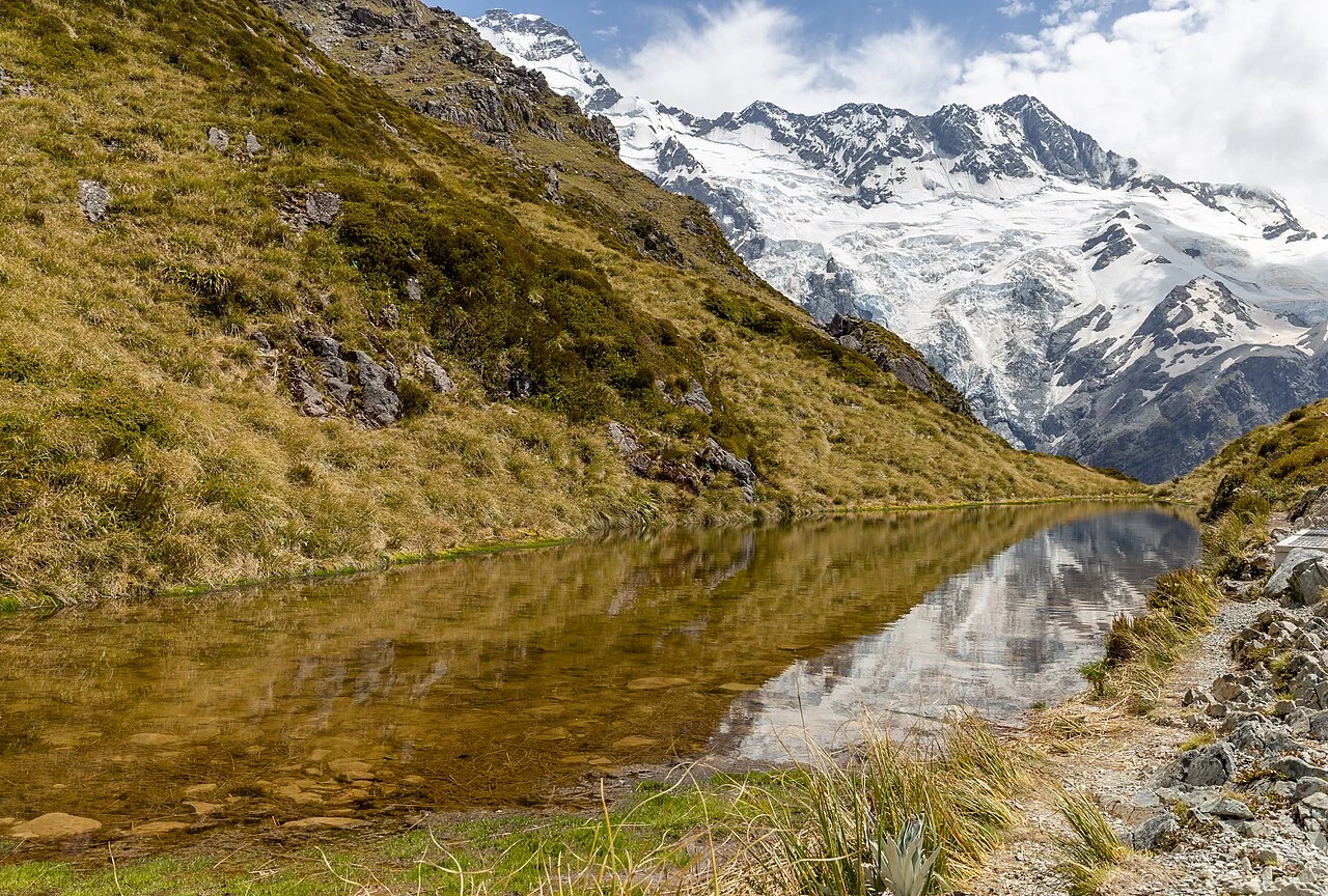
1. Roys Peak
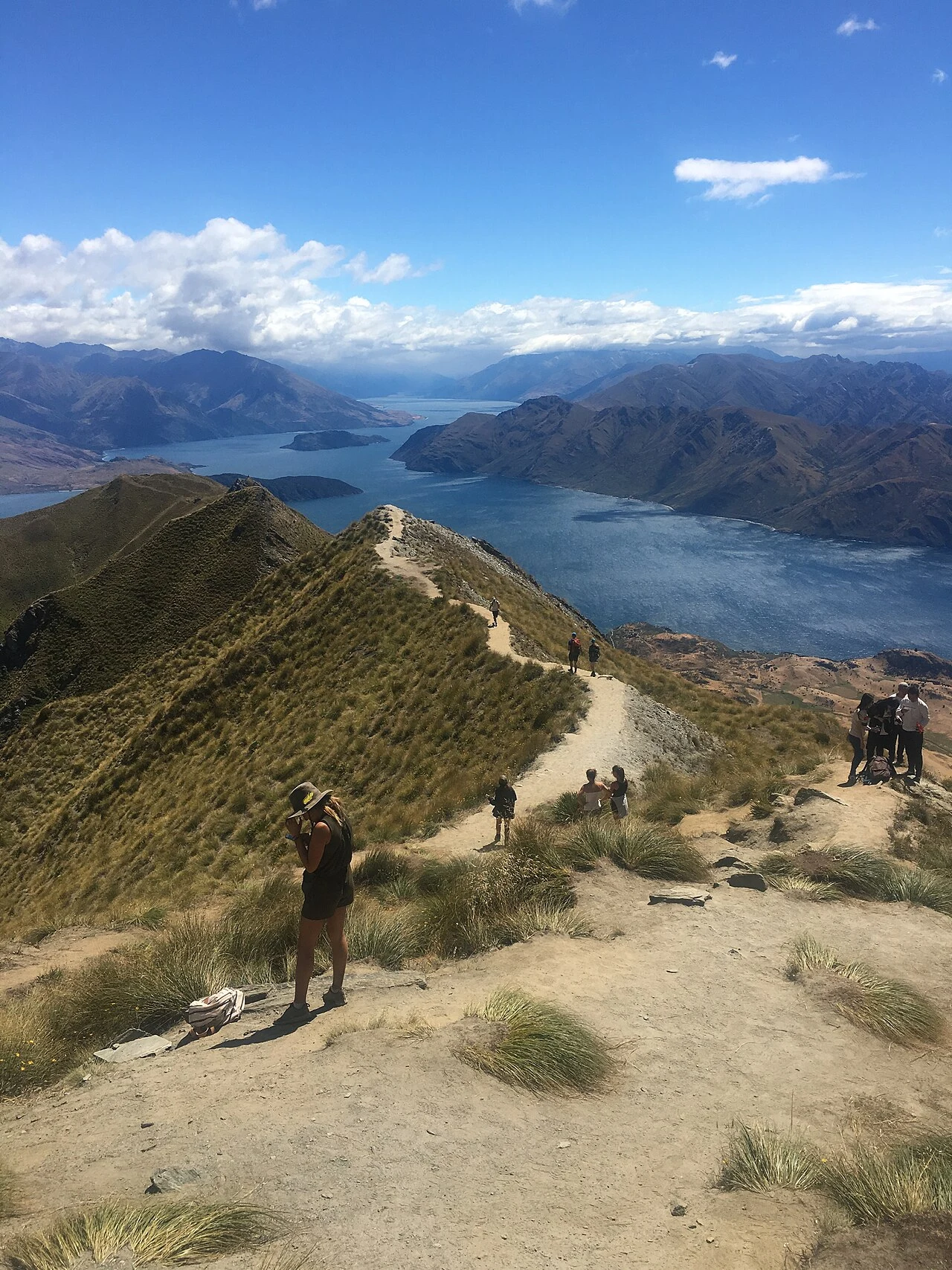
Roys Peak; historical location reference, not current trail conditions · A.ww22 · Photo source · CC BY-SA 4.0 Resized and converted to WebP
16 km return, 5–6 hours; steep and physically demanding. AllTrails maps approximately 1,284 m cumulative ascent; DOC states over 1,200 m, not summit altitude. Access is off Wanaka–Mount Aspiring Road. It is CLOSED on 15 October 2026 during the annual 1 October–10 November lambing closure. Plan December–March in suitable conditions. DOC confirms free parking; a separate trail-access tariff was not established. There is no shade or water. Remain on the marked route through private land.
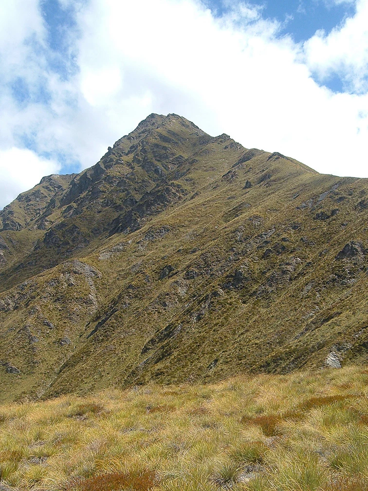
Ben Lomond New Zealand; historical location reference, not current trail conditions · Grapeman4 · Photo source · CC BY-SA 3.0 Resized and converted to WebP
From the Tiki Trail on Brecon Street, Queenstown, allow 14 km return and 6–8 hours to the summit; DOC gives 1,438 m ascent. This is strenuous, with a steeper unmaintained section above the saddle. Prefer snow-free December–March conditions; turn back for ice, strong wind or fatigue. Walking from the base avoids buying a gondola ticket; no separate access-fee notice was established. Gondola alternatives cost extra. Stay off intersecting mountain-bike tracks and carry a full day’s water.
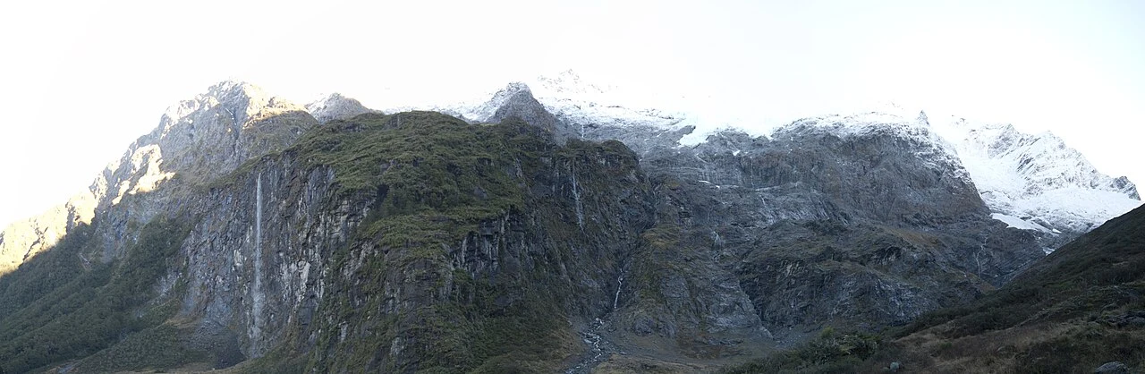
Rob Roy Glacier, June 2011 winter reference; not present ice or trail-access conditions. · Steve Collis from Melbourne, Australia · Photo source · CC BY 2.0 Resized and converted to WebP
Raspberry Creek to the upper lookout is around 10 km return and 3–4 hours. AllTrails’ roughly 10.8 km mapped route estimates 478 m cumulative ascent; GPS length differs from DOC’s rounded distance. Moderate fitness is needed, with drop-offs and slippery rocks. Prefer December–March. DOC strongly advises stopping at the lower lookout May–November, so do not apply the full-route distance to that shorter walk. Access from Wanaka is 54 km, about 1 hour 20 minutes each way, including gravel and fords. Cancel in heavy rain and confirm rental permission. Separate day-walk permit or fee terms were not established; check with DOC.
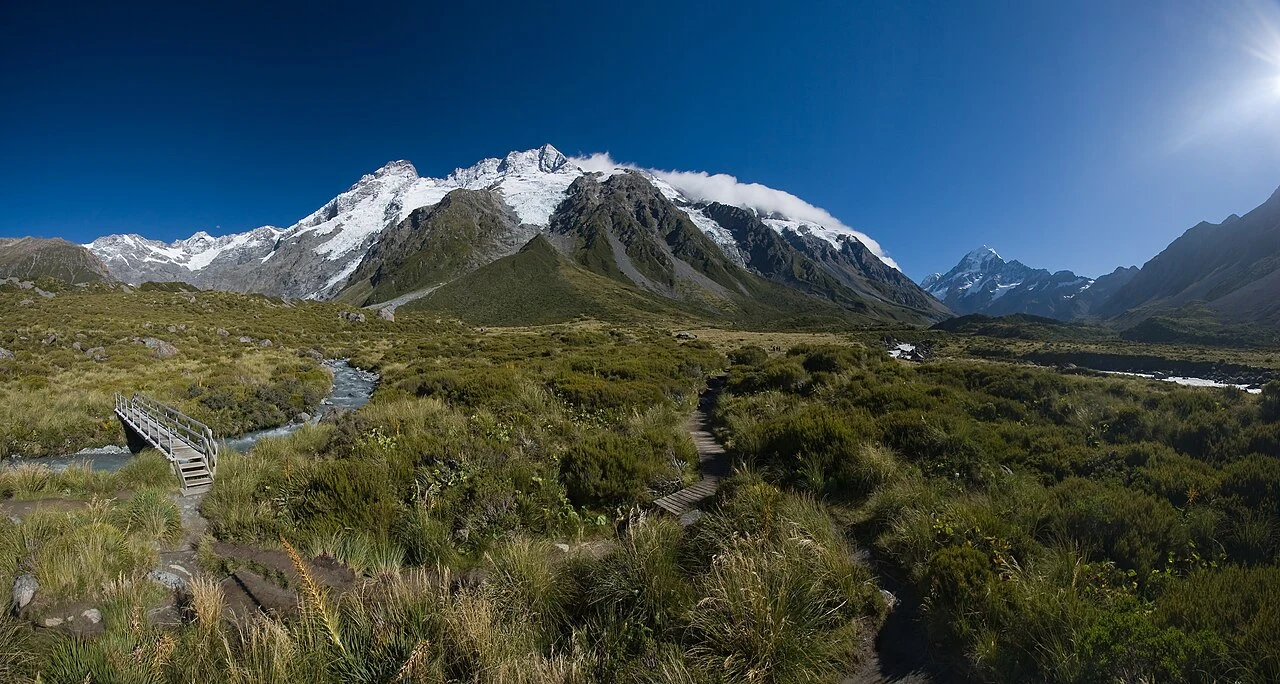
Historic Hooker Valley landscape (2008), not the rebuilt 2026 bridge or current trail conditions. · Christian Mehlführer, User:Chmehl · Photo source · CC BY 3.0 Resized and converted to WebP
White Horse Hill to Hooker Lake totals about 10 km return and three hours using DOC segments. This easier walk still has bridges, steps and exposure. The replacement second bridge opened in July 2026. NZ Breeze’s August 2026 one-way GPS records 146 m ascent and 31 m descent: retracing it implies about 177 m cumulative ascent, an editorial GPS estimate, not a DOC survey. For two equal contributors, parking costs NZ$1.25 per person per half-hour, capped at NZ$12.50 per person per day. Prefer December–March; cancel for closure, wind or icy conditions. The 2008 photograph does not show the new bridge.
Sealy Tarns; historical location reference, not current trail conditions · Michal Klajban
· Photo source · CC BY-SA 4.0 Resized and converted to WebP
From White Horse Hill allow about 5.3–5.8 km return and 3–4 hours. Around 2,200 steps make this a strenuous steep walk. AllTrails’ shorter mapped route estimates 546 m cumulative ascent; DOC separately describes 600 m height gain, which is not an identical measurement. Prefer snow-free December–March; cancel for ice or avalanche warnings. Shared parking cost is the same as Hooker Valley. No separate day-walk reservation was identified; hut stays are separate. Stop at Sealy Tarns: the onward Mueller Hut alpine route is not an automatic extension.
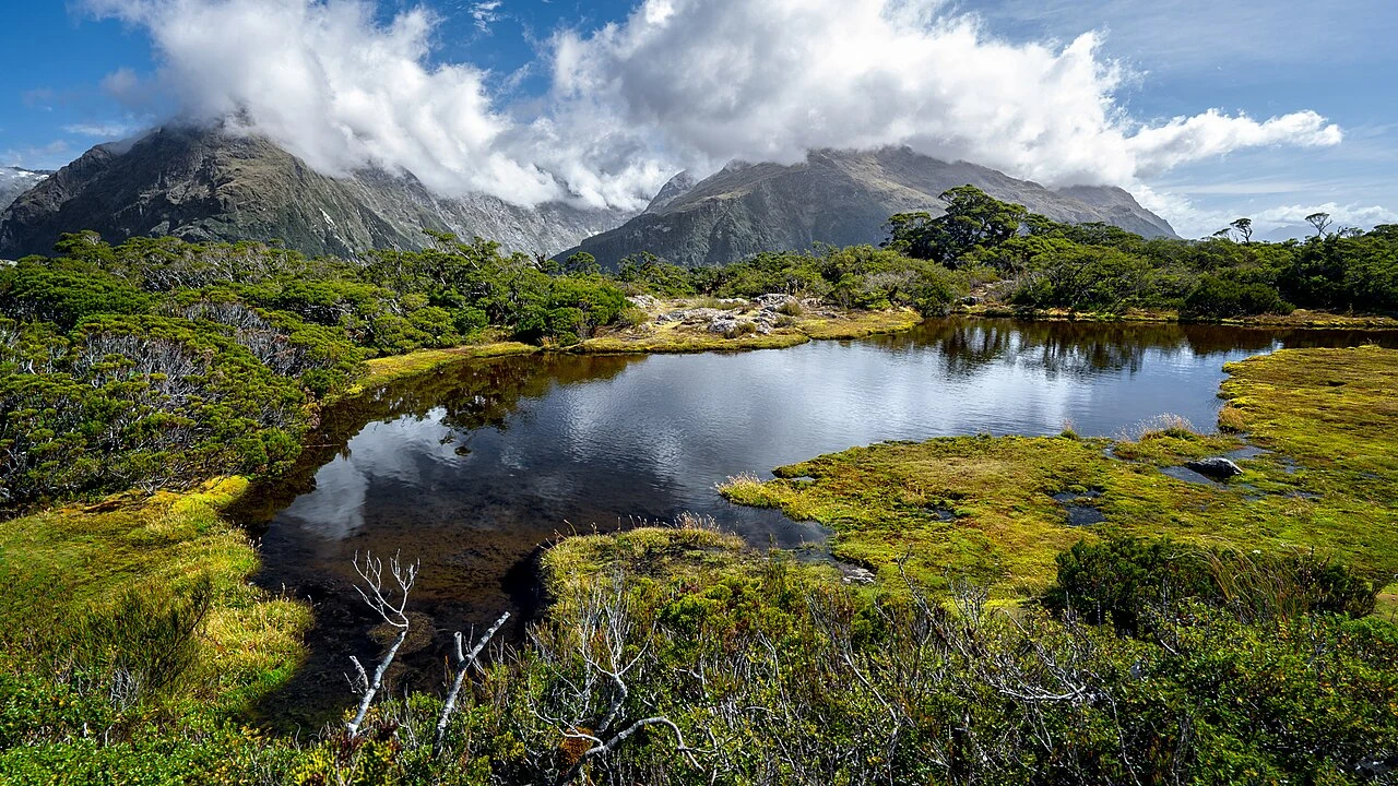
Key Summit; historical location reference, not current trail conditions ·
Ilya Grigorik · Photo source · CC BY-SA 3.0 Resized and converted to WebP
From The Divide, DOC’s commonly published route is 6.8 km return and about three hours. Including the Lake Marian viewpoint/nature-walk extension, AllTrails maps about 8 km with 421 m cumulative ascent. This is a moderate uphill half-day outing, following Routeburn before the Key Summit turn. The Divide is about 85 km along Milford Road from Te Anau; check SH94 closures. Prefer settled December–March weather and stay on boardwalks to protect wetlands. This day walk does not use Great Walk huts. Other access charges were not independently confirmed; do not assume future access is free.
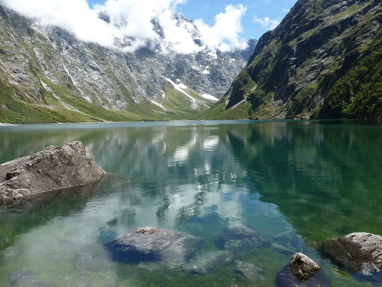
Lake Marian New Zealand; historical location reference, not current trail conditions · Michal Klajban
· Photo source · CC BY-SA 4.0 Resized and converted to WebP
Hollyford Road car park to the lake is around 6.2 km return and three hours, with AllTrails estimating 400 m cumulative ascent. Beyond the falls, steep mud, roots and rocks require good fitness and backcountry skills. The car park is about 1 km down unsealed Hollyford Road. Prefer December–March, wear long trousers against stinging nettles, avoid avalanche-exposed lakeshore terrain in winter/spring and cancel in heavy rain. This is not a simple family stroll. A separate day-walk fee or permit notice was not established; consult DOC before travel.
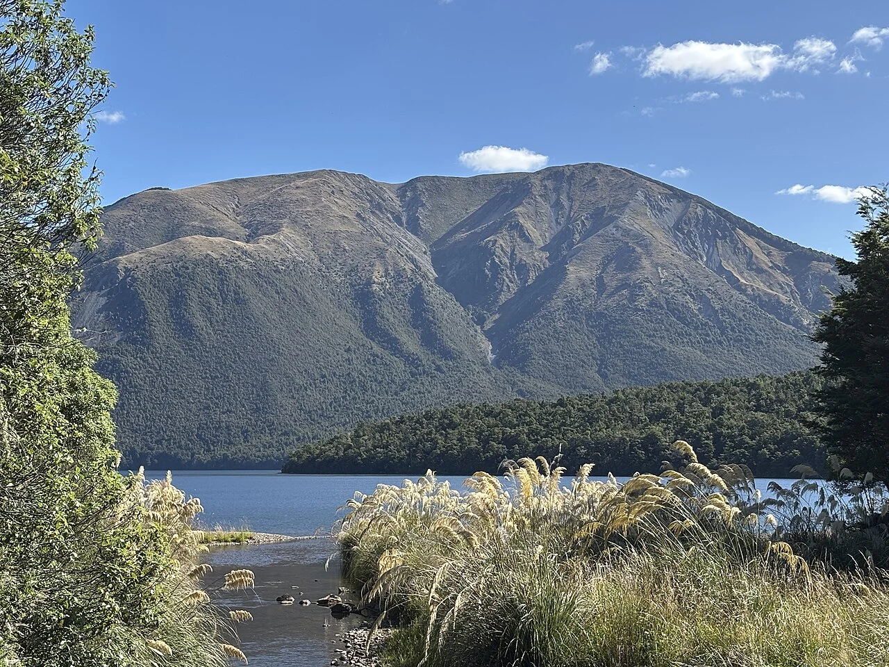
Reference view of Pourangahau / Mount Robert from the lakeside, not a photograph taken on the circuit. · Paora · Photo source · CC0 Resized and converted to WebP
Combine Pinchgut and Paddy’s tracks for about 9 km and five hours, with AllTrails estimating 636 m cumulative ascent. This is an advanced alpine walk. Reach the road-end car park from St Arnaud via SH63 and Mount Robert Road; the loop includes 500 m of road connection. Prefer December–March. The road gate closes in icy conditions; avoid the exposed ridge in wind or snow. The photo is a lakeside reference view of the mountain, not a circuit photograph. A day walk does not include a Bushline Hut stay; check hut fees separately for overnight travel. Leave no valuables in the car.
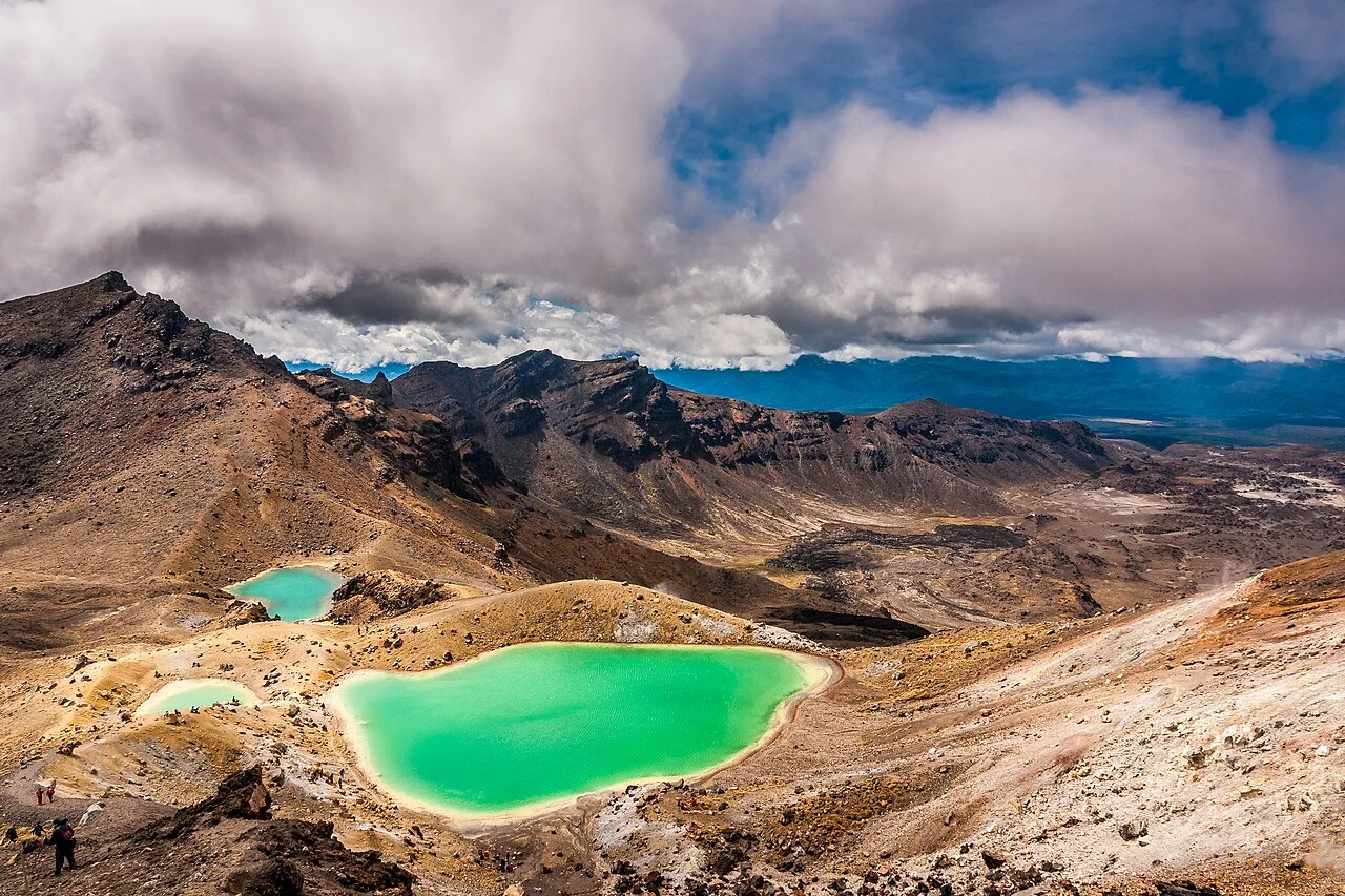
Tongariro Emerald Lakes; historical location reference, not current trail conditions · Marcus Holland-Moritz · Photo source · CC BY-SA 2.0 Resized and converted to WebP
Mangatepopo to Ketetahi is 19.4 km one way, around 7–8 summer hours. AllTrails’ approximately 20 km route estimates 853 m cumulative ascent; DOC’s ±1,196 m describes elevation change and must not be substituted. This strenuous volcanic alpine crossing is best planned for December–March. May–October requires alpine equipment and skills and is not an ordinary hiking recommendation. DOC’s free booking is recommended for everyone and required for shuttle/guided-walk users. Full-crossing hikers cannot park at the start in summer. Cancel for adverse weather, volcanic warnings or closures; stay out of lakes and off fire-recovery areas.
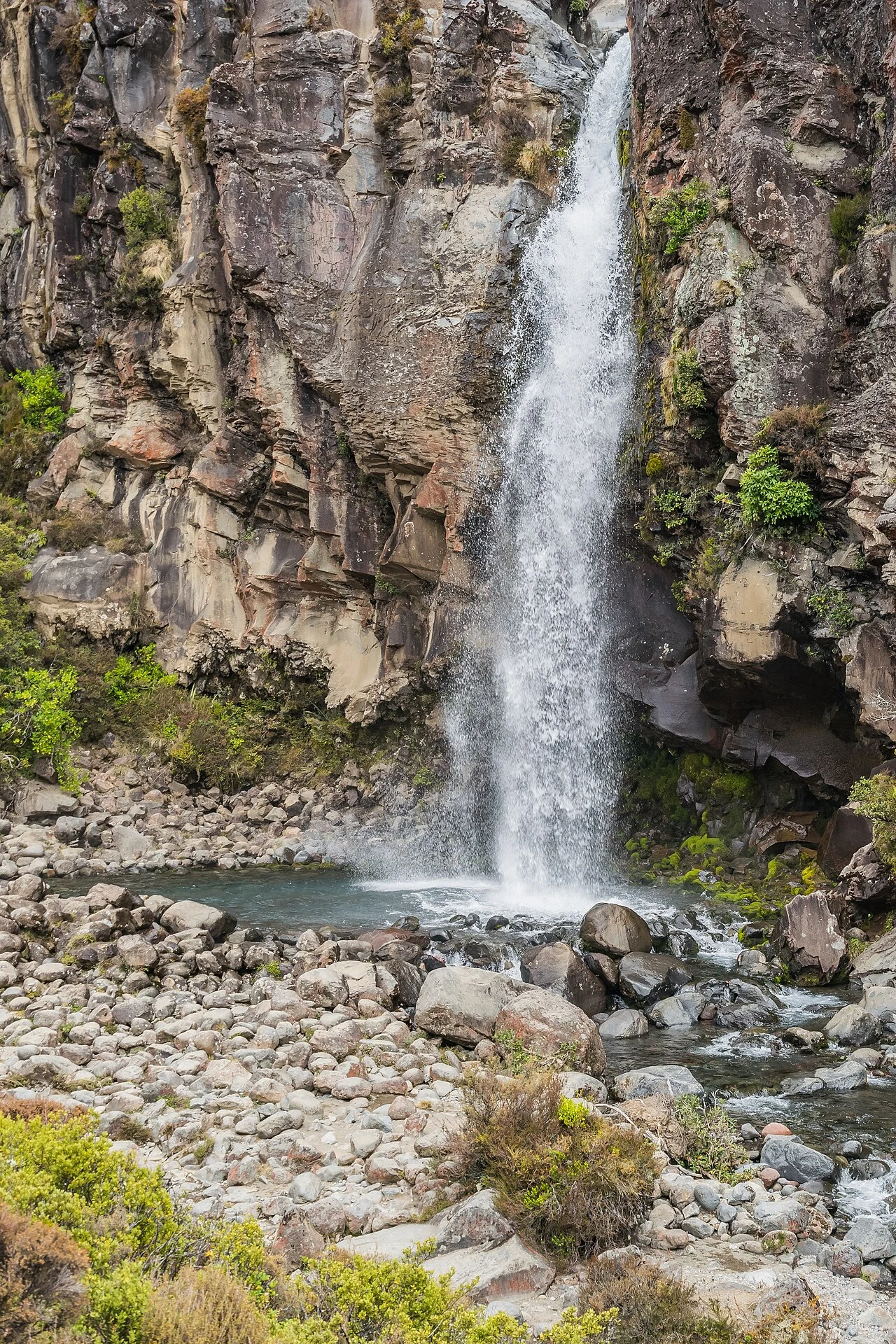
Taranaki Falls; historical location reference, not current trail conditions · Krzysztof Golik · Photo source · CC BY-SA 4.0 Resized and converted to WebP
Start at Ngauruhoe Place in Whakapapa for about 6 km loop and two hours. AllTrails estimates 153 m cumulative ascent. The easier walk still has roughly 100 steps near the waterfall; 20 m is the waterfall height, not ascent. Prefer November–April, check volcanic/weather notices and postpone for ice. Village lodging allows walking to the trailhead without a shuttle. No separate access-fee or permit notice was established; this is not a permanent free-access promise. The day loop requires no hut stay.
These ten candidates are distributed nationwide, not a one-week circuit. Three days/two nights stays in Queenstown with one full Ben Lomond hiking day. Seven days/six nights adds Wanaka, Roys Peak and Rob Roy, with easier days between strenuous outings. Use this plan in December–March only when routes are open and conditions suit. Assume afternoon arrival and departure no earlier than the final afternoon; do not climb immediately after a long-haul flight.
When to go and what to pack
Prefer December–March for open, snow-free alpine routes. Summer can still bring snow, strong winds and abrupt cold. Carry waterproof and insulating layers, long trousers, grippy hiking footwear, sun protection, a headtorch, offline navigation, food and sufficient water. Historic photographs do not establish current snow or glacier conditions.
Two complete itineraries
Choose one complete itinerary below. Suggested local times allow for meals and breaks; swap days around opening calendars and dated reservations.
Arrive in the afternoon and take the airport bus or a reserved transfer to central Queenstown. Choose accommodation within walking distance of Brecon Street. Take only a 30–60 minute lakeside stroll, then prepare tomorrow’s packed lunch, water and layers. Review DOC notices and the mountain forecast, and leave your plan with a contact. Night one in Queenstown.
Day 2 · A full Ben Lomond day
When conditions and fitness allow, start early on the Tiki Trail beside the Brecon Street gondola base. DOC gives 14 km return, 6–8 hours and 1,438 m of ascent to the summit; add break time and set a turnaround deadline for daylight. The steeper summit section crosses private land. Turn back in ice, strong wind or fatigue and never shortcut on mountain-bike trails. Return to the same hotel for night two.
Day 3 · Recovery and departure
After breakfast take a gentle lakeside walk or rest at a café, then check out and head to the airport with a transport buffer in addition to the airline’s check-in margin. No second alpine route is scheduled. Do not squeeze a weather-cancelled summit into the hours before your flight. Leave directly for an early flight; no additional night.
Deeper stay · 7 days / 6 nights
Day 1 · Arrive in Queenstown
Take the bus or a reserved transfer to a central hotel after an afternoon arrival. Take a short lakeside walk, buy trail food and check tomorrow’s mountain forecast. No out-of-town drive or summit is planned. Night one in Queenstown.
Day 2 · Ben Lomond
When conditions and fitness allow, start early on the Tiki Trail beside the Brecon Street gondola base. DOC gives 14 km return, 6–8 hours and 1,438 m of ascent to the summit; add break time and set a turnaround deadline for daylight. The steeper summit section crosses private land. Turn back in ice, strong wind or fatigue and never shortcut on mountain-bike trails. Return to the same hotel for night two.
Day 3 · Transfer to Wanaka and recover
Collect the reserved car in the morning and confirm permitted roads and insurance. Use Crown Range only with suitable conditions and confidence on mountain roads; allow around 70–74 km and about 1 hour to 1 hour 10 minutes of driving, plus stops. The official Wanaka alternative via Cromwell is approximately 1 hour 15 minutes and more gradual; check closures rather than assuming it is always open. Settle into Wanaka, then take a short lakeside stroll and rest. Night three in Wanaka.
Day 4 · Roys Peak
Drive about 6 km west on Mount Aspiring Road to the official car park, allowing roughly 15 minutes each way plus parking time. Parking is free, but roadside parking is prohibited. Hike only after 10 November and in suitable snow-free weather. Start early for the 16 km return walk, around 5–6 hours plus breaks, with over 1,200 m of ascent. The familiar photo viewpoint precedes the summit by about 30 minutes; continue only if fit and conditions allow. Night four in Wanaka.
Day 5 · Recovery and weather buffer
Take a short Wanaka lakefront walk, restock food and rest. If day four was unsuitable, move Roys Peak here and drop day six’s Rob Roy hike to avoid consecutive demanding days. Do not force a summit for the checklist. Confirm Raspberry Creek road conditions, fords and rental permissions before deciding on Rob Roy. Night five in Wanaka.
Day 6 · Rob Roy glacier viewpoints
Only in December–March with suitable road, avalanche and track conditions and explicit rental permission, drive the approximately 54 km to Raspberry Creek. DOC estimates 1 hour 20 minutes each way; the last 30 km is gravel and the final 10 km has fords. Cancel during heavy rain or high water. Allow 3–4 hours plus breaks for the approximately 10 km return hike and stop at the upper lookout. Return to Wanaka for night six. If access is unsuitable, rest by the lake; do not force a ford crossing or assume motorhomes are suitable.
Day 7 · Return to Queenstown and depart
Return to Queenstown according to current road conditions, planning roughly 70–74 km and 1 hour to 1 hour 10 minutes of driving, plus refuelling, car return and airport queues. This suits afternoon or evening departures; an early flight requires moving the final night to Queenstown and changing the lodging plan. No hike is scheduled, and flight pressure is no reason to rush mountain roads.
Getting around and where to stay
Stay centrally in Queenstown for walking access to the Tiki Trail. The longer plan collects a car on day three and adds Wanaka nights. Drive on the left and allow mountain-road buffers; confirm gravel-road, ford and insurance exclusions. Cancel Rob Roy if Raspberry Creek access is unsuitable. Recheck DOC and road notices before departure; an absent closure banner is not an assurance of access.
Optional travel tools
This guide focuses on trail selection. No sufficiently verified Viator comparison was available, so no unverified product rating or affiliate excursion is listed. Less experienced hikers should arrange an established guide and obtain a separate quote.
Car rental option
We may earn a commission when you book through our affiliate links, at no extra cost to you.
A | Families: match the least experienced walker. Long alpine outings are not general family strolls; DOC advises against the Crossing for children under ten.
B | Partners and companions: recover after long flights and agree a turnaround time. Fatigue or deteriorating weather is sufficient reason to cancel.
C | Pets: this selection is not a pet itinerary. Check each official policy rather than assuming access.
D · Separate per-person budgets
Every figure below is a per-person, full-trip USD planning allowance, not a live quote. Room costs assume equal sharing with one companion; solo travellers replace that share with their full room cost. Shared transport uses the same split where stated; per-person tickets and experiences are not divided again. International flights, visas, insurance and shopping are excluded. Replace with tax-inclusive quotes and deduct meals/admission already included in an experience. CAD uses an illustrative 1 USD = 1.40 CAD, not a live exchange rate. The PDF contains static examples; the two website calculators can be edited independently.
Short stay · 3 days / 2 nights
Per-person planning example: US$350, or about C$490 using an illustrative 1 USD = 1.40 CAD conversion, not a current exchange rate. Lodging is an US$80 personal nightly share for two nights, sharing with one companion. Food is US$40/day for three days, local transport allowance US$20, contingency US$50. A zero experience line means no guide, gondola or optional activity is included; it does not promise free access everywhere. These editable assumptions are not supplier quotes. Flights, insurance, new equipment and any newly introduced fees are excluded.
Per-person allowance
USD
CAD × 1.40
Accommodation
160.00
224.00
Meals
120.00
168.00
Local transport / transfers
20.00
28.00
Selected experience allowance
0.00
0.00
Other admission / extras
0.00
0.00
Reserve
50.00
70.00
Total per person
350.00
490.00
Deeper stay · 7 days / 6 nights
Per-person planning example: US$1,095, about C$1,533 at an illustrative 1 USD = 1.40 CAD. Lodging is an US$80 nightly personal share for six nights with one companion; meals are US$40/day for seven days. Transport allowance US$235 consists of local buses US$10, five days of rental-car personal share US$175, fuel share US$30 and parking share US$20. Car costs assume two equal contributors; no whole-car total is displayed. Contingency is US$100. The rental allowance is not a quote: confirm cover, deposit, permitted roads and excess separately. Guides, international flights, equipment and new access charges are excluded. Already per-person bus fares are not divided again.
Per-person allowance
USD
CAD × 1.40
Accommodation
480.00
672.00
Meals
280.00
392.00
Local transport / transfers
235.00
329.00
Selected experience allowance
0.00
0.00
Other admission / extras
0.00
0.00
Reserve
100.00
140.00
Total per person
1,095.00
1,533.00
For a lower-cost trip, choose the independent route and remove the optional guided-experience allowance. For extra comfort, raise the room or transfer allowance. Choose the short OR long budget; do not add both totals.
Before departure
Canada’s advice checked 15 October 2026 lists normal security precautions for New Zealand, without an avoid-travel warning covering these routes. This does not remove mountain hazards. Travel with others, leave a return plan, consider a PLB and hire a reputable guide if inexperienced. Respect sacred sites and Tongariro’s fire-recovery restrictions; stay on marked trails and out of volcanic lakes.
Check opening calendars, strikes or closures, and dated ticket inventory again shortly before travelling. This evergreen route makes no claim that a future festival is scheduled or on sale.
READER OFFER · 10% OFF
Saily travel eSIM · 10% off
Stay connected for maps, transport and travel plans. Compare coverage, data allowance, validity, activation rules and unlocked-device compatibility before buying.
This link includes the coupon for automatic application. If it is not shown at checkout, enter HAPPYTOGETHER manually.
Applies to new purchases across all Saily plans and destinations. No expiry date has been set. Combining this code with other promotions has not been confirmed; check the discount and final total at checkout.
Affiliate disclosure: Happy Together Trips may earn a commission on eligible purchases through this link, at no extra cost to you.
Selection evidence and sources
This is an editorial selection, not a live national or global popularity ranking. We compared World Wild Hearts’ 2025 New Zealand overview with Adventures of Lauren & Jason’s South Island video: national mountain destinations versus a South Island hiking focus. YouTube oEmbed confirmed titles and creators, but current views, likes and comments were unavailable, as were verified Instagram post metrics. DOC describes Roys Peak as a popular day hike; that is not a platform ranking.
Research checked 15 October 2026. YouTube figures below are search-index snapshots, not live counters; publication dates and missing fields are shown as available. Videos were not copied or treated as a platform ranking. Instagram access and any missing or conflicting fields are described beside each source; unavailable metrics are excluded from quantitative comparisons. Only accessible public metadata was reviewed, not entire video content. Sources have different periods and measures; they are not a cross-city league table.
World Wild Hearts 2025 in the title; exact upload date unavailable. Checked 2026-10-15: creator/title verified through YouTube oEmbed; views, likes and comments unavailable. National destination overview, not a hiking ranking.
Adventures of Lauren & Jason Secondary index reports 2025-10-18; exact date not confirmed on original. Creator/title confirmed through YouTube oEmbed on 2026-10-15. Current views, likes and comments unavailable; South Island itinerary comparison only.