North America · Canada · Alberta / British Columbia / Québec / Newfoundland and Labrador · HAPPY TOGETHER TRIPS
Canada Top 10 scenic hikes: western and eastern choices plus 4/7-day Banff plans
Choose among ten routes from Rocky Mountain lakes to Québec highlands and Newfoundland valleys, guided by fitness, season and access. This is an editorial selection, not an official ranking or a one-week crossing of Canada.
Checked 15 October 2026. Times are suggested local planning times, not reservations. Climate is not a forecast.
Activities and official booking checks
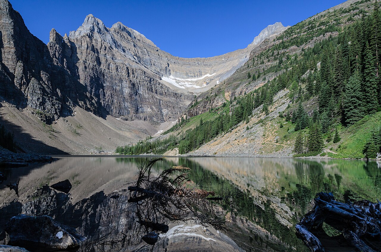
Lake Agnes
Lake Agnes and surrounding mountain walls in Banff National Park · Florian Fuchs · Photo source · CC BY 3.0 Resized JPEG; original licence retained.
7.8 km return; approximately 575 m ascent (basis below); 2.5–3 hours; moderate. Recommended snow-free months: 7–9. 3.9 km each way; return ascent calculated from official outbound gain 495 m plus loss 80 m. Start at the Lake Louise lakeshore and turn back at Lake Agnes; the Big Beehive extension is excluded. Reserve shuttle transport or check Roam 8 X; lakeshore parking is not guaranteed. Expect roots and stones and carry supplies rather than relying on the seasonal teahouse.
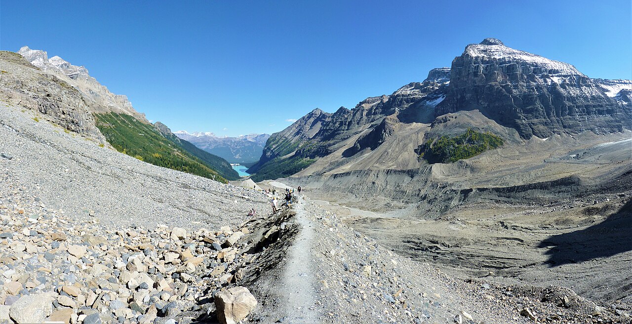
Looking back at Lake Louise from the Plain of Six Glaciers. · LPeezy · Photo source · CC BY-SA 4.0 Resized JPEG; original licence retained.
11.8 km return; approximately 845 m ascent (basis below); 4 hours; moderate. Recommended snow-free months: 7–9. 5.9 km each way; outbound 595 m gain plus 250 m loss gives 845 m return ascent. Shares the Lake Louise start with Lake Agnes but deserves a separate day. Enjoy the glacial valley from the marked trail; do not step onto a glacier. Carry lunch and respect rockfall and steep-ground hazards.
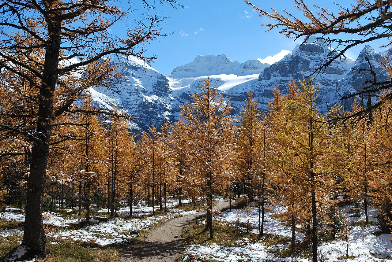
Golden larches and snow in Larch Valley: autumn landscape reference · Paul Anthony Stewart · Photo source · CC BY-SA 4.0 Resized JPEG; original licence retained.
9 km return; approximately 580 m ascent (basis below); 3.5–4 hours; moderate. Recommended snow-free months: 7–9. 4.5 km each way; 570 m outbound gain plus 10 m loss gives 580 m return ascent. Start at Moraine Lake. July–August bring greener scenery; September may bring golden larches, with no exact colour guarantee. Stop in the Minnestimma lakes area, excluding Sentinel Pass. The 2026 shuttle season has ended and road access closed October 13; 2027 service dates remain unconfirmed.
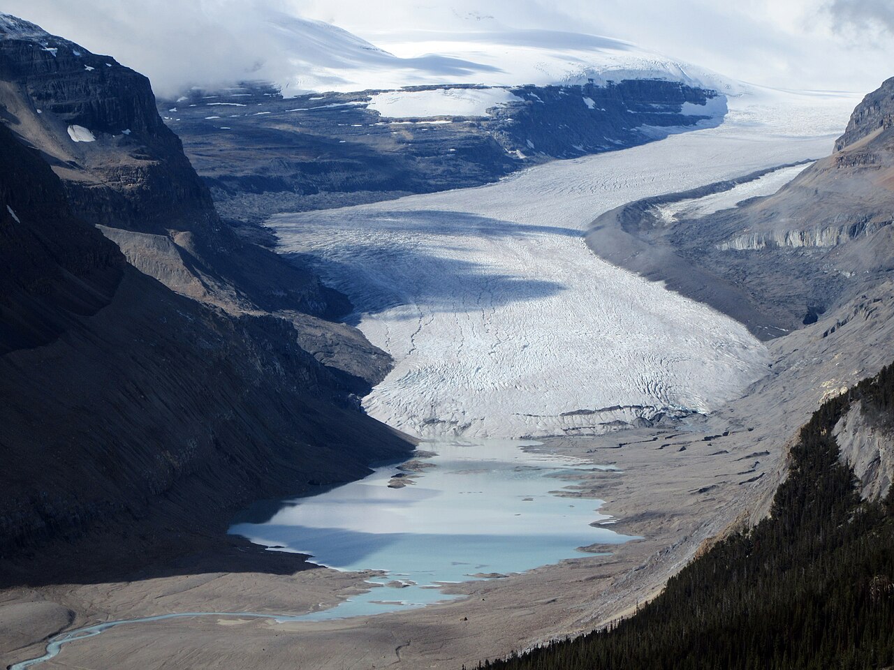
Saskatchewan Glacier, Parker Ridge Trail, Icefields Parkway, Alberta · amanderson2 · Photo source · CC BY 2.0 Resized JPEG; original licence retained.
5.4 km return; approximately 350 m ascent (basis below); 2.5 hours; moderate. Recommended snow-free months: 7–9. 2.7 km each way; 305 m outbound gain plus 45 m loss gives 350 m return ascent. Start from the Icefields Parkway trailhead 40 km north of Saskatchewan Crossing. This is a separate parkway option, farther away than Lake Louise, and is not squeezed into the short itinerary. The ridge is exposed to wind; the current report includes snow and ice, so this is not a beginner winter walk.
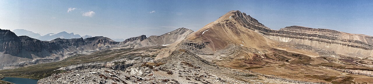
Cirque Peak and Helen Lake (lower left) in Banff National Park, Canada. · Edna Winti · Photo source · CC BY 2.0 Resized JPEG; original licence retained.
11.8 km return; approximately 620 m ascent (basis below); 4–5 hours; moderate. Recommended snow-free months: 7–9. 5.9 km each way; 530 m outbound gain plus 90 m loss gives 620 m return ascent. Start opposite the Crowfoot Glacier viewpoint, about 33 km north of the Lake Louise junction. The lake and alpine meadows are the goal; a Cirque Peak scramble is not included as ordinary hiking. Upper sections can hold snow; change plans for thunderstorms or poor visibility.
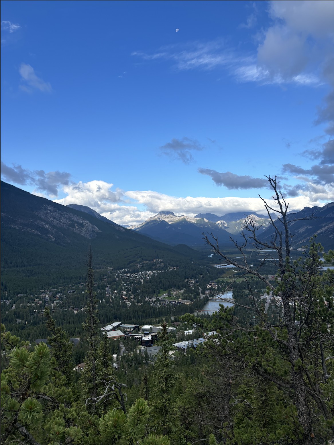
Banff town seen from Tunnel Mountain in August 2024 · 448student · Photo source · CC0 Resized JPEG; original licence retained.
4.6 km return; approximately 275 m ascent (basis below); 2 hours; moderate. Recommended snow-free months: 6–9. 2.3 km each way; official listed gain 275 m, with no separate descent value. Begin at the lower St Julien Road parking area in Banff, roughly a 1 km walk from downtown. This is a useful second-day fitness check with valley views. Follow parking signs and do not park along the road. The October 15 report described mainly dry conditions, not a guarantee against later ice.
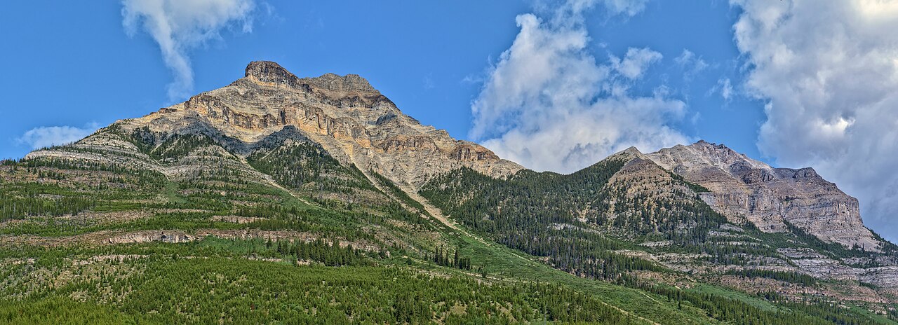
Mount Whymper seen from Stanley Glacier Trail; not a close-up of the glacier · The Cosmonaut · Photo source · CC BY-SA 2.5 ca Resized JPEG; original licence retained.
9.8 km return; approximately 520 m ascent (basis below); 3 hours; moderate. Recommended snow-free months: 7–9. 4.9 km each way; 405 m outbound gain plus 115 m loss gives 520 m return ascent. Park at the signed Stanley Glacier trailhead on Highway 93 S in Kootenay and stay on the official valley route. Do not enter the glacier or improvise fossil-hunting slopes. Mobile service is limited. The official October 5 observation was good; conditions may have changed since and require a fresh check.
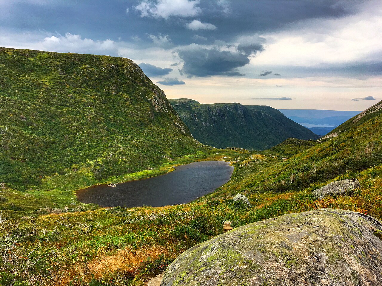
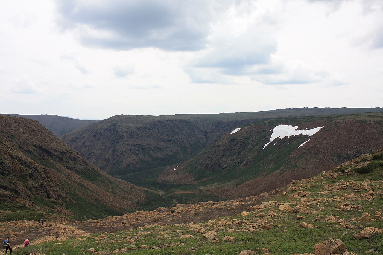
View hiking Gros Morne Mountain · BlueDrury · Photo source · CC BY-SA 4.0 Resized JPEG; original licence retained.
17 km return; approximately 1000 m ascent (basis below); 6–8.5+hours; difficult. Recommended snow-free months: 7–9. Official full 17 km return with 1000 m gain; the approach-only alternative is 9 km and 463 m. A separate Newfoundland trip from the Rocky Harbour area to the signed mountain trailhead, not an add-on to a Banff week. Includes the approach and summit loop; 806 m summit altitude is not ascent. Use the clockwise scree ascent and turn back below the summit for cloud or fatigue. The summit closes annually May 1–June 27; the park discourages winter summit hiking from mid-October.
Grande Cuve of Mont Albert: regional landscape reference, not a photograph documenting the entire north route · Thekidpossum · Photo source · CC BY-SA 4.0 Resized JPEG; original licence retained.
11.6 km return; approximately 860 m ascent (basis below); 5 hours; expert. Recommended snow-free months: 7–9. Official north-side return route 11.6 km with 860 m gain. A separate Gaspésie trip in Québec, starting at the park discovery and visitors centre. Sustained climbing and an exposed summit earn an official expert rating; urban walking fitness alone is insufficient. This is the north-side return route, not the 17.3 km circuit. Its 2026 season ran June 13–October 12 and has ended; 2027 dates are unconfirmed.
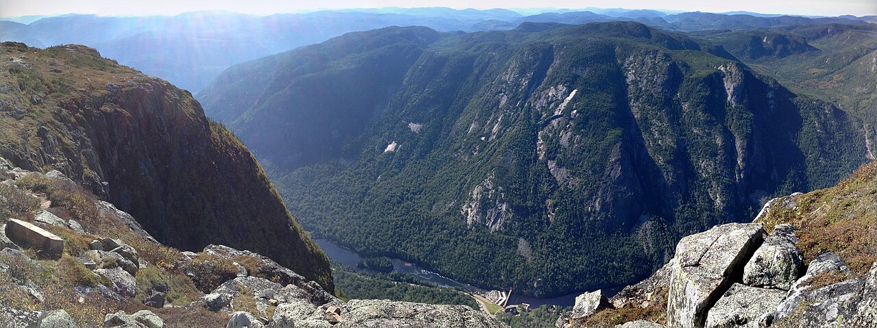
Valley panorama from Acropole des Draveurs · NDamboise · Photo source · CC BY-SA 4.0 Resized JPEG; original licence retained.
11.2 km return; approximately 800 m ascent (basis below); 4–6 hours; difficult. Recommended snow-free months: 7–9. Official 11.2 km return and 800 m gain. A separate Charlevoix option in Québec, starting at the Pin-Blanc campground trailhead after checking internal road or shuttle access. A steep climb overlooks the Malbaie valley. Carry at least 2 L of water, leave dogs at home and obey the official latest-start and descent times. Closed for the season from October 13, 2026; exact 2027 reopening remains unconfirmed.
Choose a region before a trail. Seven entries are in the Rockies, two in Québec and one in Newfoundland, offering contrasting landscapes without pretending to cover every Canadian region. Numbers are not ranks. Both the 4-day/3-night and 7-day/6-night plans use only a Banff/Lake Louise subset; the eastern entries are separate destination ideas. Marked hiking is distinct from technical climbing; glacier travel, rock climbing and off-trail summits are excluded.
When to go and what to pack
This is a future snow-free-season planning guide, not an immediate October 2026 departure list. July–September generally offers better alpine access, but early July can retain snow and September can bring sudden snowfall. Carry a waterproof windproof shell, insulation, grippy hiking footwear, gloves, hat and headlamp. Check local forecasts and park reports daily; shorten or cancel for summit thunderstorms, snow or low cloud. Autumn larches and regional panoramas are labelled, not presented as summer photographs.
Two complete itineraries
Choose one complete itinerary below. Suggested local times allow for meals and breaks; swap days around opening calendars and dated reservations.
Collect a car and allow roughly 130–150 km and 1.5–2 hours driving to Banff, depending on airport or city origin. Check into the same accommodation for three nights. Buy lunch supplies and check rain layers and water. Keep the afternoon to a short riverside walk rather than a summit after a long flight.
Day 2 | Tunnel Mountain and recovery
Walk to the lower trailhead and allow about two hours plus photo stops for the 4.6 km return hike. Rest in town afterward and confirm tomorrow’s transport and weather. The car can stay parked; this is a fitness check, not a packed activity day.
Day 3 | A full Lake Agnes day
Drive about 58 km and 45–60 minutes each way to the Lake Louise area, adding time for parking, transfers and waiting. Use confirmed transport to the lakeshore and hike the 7.8 km Lake Agnes return with packed lunch. Choose only the lakeshore if fitness or weather is unsuitable; return to Banff without adding Big Beehive.
Day 4 | Return to Calgary
After breakfast drive roughly 130–150 km and 1.5–2 hours back, adding fuel, car-return and airport time. A late flight may allow a town stroll, not a remote mountain hike on departure day.
Deeper stay · 7 days / 6 nights
Day 1 | Calgary to Banff
Collect a car and allow roughly 130–150 km and 1.5–2 hours driving to Banff, depending on airport or city origin. Check into Banff accommodation for two nights. Buy lunch supplies and check rain layers and water. Keep the afternoon to a short riverside walk rather than a summit after a long flight.
Day 2 | Tunnel Mountain and recovery
Walk to the lower trailhead and allow about two hours plus photo stops for the 4.6 km return hike. Rest in town afterward and confirm tomorrow’s transport and weather. The car can stay parked; this is a fitness check, not a packed activity day.
Day 3 | Move to Lake Louise
Drive about 58 km and 45–60 minutes to Lake Louise and check in for four nights. Keep the afternoon to gentle lakeshore time or rest. Confirm transport for both hiking days; a lakeshore hotel does not automatically include shuttle reservations.
Day 4 | Lake Agnes
Follow the same 7.8 km route used in the short plan, allowing at least 2.5–3 hours plus lunch. Start early and use the afternoon to dry and reorganise gear. Stay in Lake Louise rather than commuting back to Banff.
Day 5 | Weather buffer and rest
This is a deliberate recovery day and can swap with a wet hiking day. Choose the visitor centre, coffee and resupply in poor weather; fine weather does not require another summit. Check water, foot condition and tomorrow’s turnaround time.
Day 6 | Six Glaciers or Larch Valley
With suitable fitness and weather choose the 11.8 km Plain of Six Glaciers hike, allowing at least four hours. For autumn larches with confirmed Moraine Lake transport, substitute the 9 km Larch Valley route. These are alternatives, never combined. Cancel the Larch option if road or shuttle access is closed; do not drive around restrictions.
Day 7 | Lake Louise to Calgary
Allow roughly 186–200 km and 2–2.5 hours driving from Lake Louise to Calgary, depending on city or airport destination, plus traffic, fuel, return and check-in time. Do not detour north to Parker Ridge before a flight.
Getting around and where to stay
The short trip uses three Banff nights; the longer trip uses two Banff and four Lake Louise nights. Use a standard rental car plus reserved lake transport. Pure driving times are planning estimates without stops, parking, queues, wildlife or construction delays; check 511 Alberta/DriveBC and park closures. Checked October 15, 2026: Banff adult daily entry CAD 12.25 and adult Discovery Pass CAD 83.50. The adult Parks Canada lake shuttle is CAD 12.75, plus CAD 1.75 per person when two share the online booking fee. The 2026 paid lakeshore parking season ended October 12; future prices need rechecking. The current peak-season parking example is CAD 21 per person/day when two share. Ordinary private vehicles cannot use Moraine Lake Road. These are not promised 2027 prices or schedules. Sépaq parks separately charge CAD 10.30 adult daily entry and do not accept the Parks Canada pass; Gros Morne adult daily entry is CAD 12.25. A commercial tour is not required for ordinary day hiking, but entry fees, designated transport and restrictions still apply. RVs are not assumed; verify large-vehicle parking, campsites and shuttle access separately.
Optional travel tools
No unverified commercial hiking product is recommended; official trail and reservation pages are the primary references.
Car rental option
We may earn a commission when you book through our affiliate links, at no extra cost to you.
A | Families: choose for the least capable member. Even Tunnel Mountain has ascent and exposed edges and is not an accessible path. Gros Morne, Mont Albert and Acropole are not default beginner-child outings.
B | Couples: share navigation tasks but each carry insulation; agree a turnaround time and keep the recovery day despite photo ambitions.
C | Pets: verify every park and trail. Acropole bans dogs; permission elsewhere does not imply universal access. Do not leave animals waiting in a vehicle.
D · Separate per-person budgets
Every figure below is a per-person, full-trip USD planning allowance, not a live quote. Room costs assume equal sharing with one companion; solo travellers replace that share with their full room cost. Shared transport uses the same split where stated; per-person tickets and experiences are not divided again. International flights, visas, insurance and shopping are excluded. Replace with tax-inclusive quotes and deduct meals/admission already included in an experience. CAD uses an illustrative 1 USD = 1.40 CAD, not a live exchange rate. The PDF contains static examples; the two website calculators can be edited independently.
Short stay · 4 days / 3 nights
D | Static per-person example USD 830/CAD 1162 at an illustrative 1 USD=1.40 CAD, not a live exchange rate or quote. Three nights at USD 110 per person/night assuming two adults share one room. USD 200 transport covers this person’s rental, insurance, fuel, parking and shuttle allocation; shared costs are split equally, individual shuttle fares are not halved. USD 40 entry is personal. Food USD 180 and contingency USD 80; international flights, travel insurance and equipment purchases excluded.
Per-person allowance
USD
CAD × 1.40
Accommodation
330.00
462.00
Meals
180.00
252.00
Local transport / transfers
200.00
280.00
Selected experience allowance
0.00
0.00
Other admission / extras
40.00
56.00
Reserve
80.00
112.00
Total per person
830.00
1,162.00
Deeper stay · 7 days / 6 nights
D | Static per-person example USD 1480/CAD 2072 at illustrative 1 USD=1.40 CAD. Six nights at USD 110 per person/night with two sharing a room. USD 300 transport is this person’s rental, insurance, fuel, parking and two hiking-day shuttle allocation; individual tickets are not halved. USD 65 allows for a personal park pass, USD 315 for food and USD 140 for contingency. Flights, travel insurance and equipment purchases are extra. Rest days still incur lodging and meals.
Per-person allowance
USD
CAD × 1.40
Accommodation
660.00
924.00
Meals
315.00
441.00
Local transport / transfers
300.00
420.00
Selected experience allowance
0.00
0.00
Other admission / extras
65.00
91.00
Reserve
140.00
196.00
Total per person
1,480.00
2,072.00
For a lower-cost trip, choose the independent route and remove the optional guided-experience allowance. For extra comfort, raise the room or transfer allowance. Choose the short OR long budget; do not add both totals.
Before departure
The Canadian government advisory index was checked October 15, 2026. It addresses foreign destinations; no foreign-advisory rating is invented for this domestic itinerary and no foreign transit route is added. Park notices govern actual access: Moraine Lake shuttle season has ended; the Johnston Canyon main trail is closed and excluded from this ten; Mont Albert north and Acropole are seasonally closed; Gros Morne discourages winter summits from mid-October. In bear country carry accessible bear spray and know its use, travel together, leave a plan and carry offline navigation and emergency communication. Mobile reception is not a sole safety system. Open access is not a safety guarantee.
Check opening calendars, strikes or closures, and dated ticket inventory again shortly before travelling. This evergreen route makes no claim that a future festival is scheduled or on sale.
READER OFFER · 10% OFF
Saily travel eSIM · 10% off
Stay connected for maps, transport and travel plans. Compare coverage, data allowance, validity, activation rules and unlocked-device compatibility before buying.
This link includes the coupon for automatic application. If it is not shown at checkout, enter HAPPYTOGETHER manually.
Applies to new purchases across all Saily plans and destinations. No expiry date has been set. Combining this code with other promotions has not been confirmed; check the discount and final total at checkout.
Affiliate disclosure: Happy Together Trips may earn a commission on eligible purchases through this link, at no extra cost to you.
Selection evidence and sources
Recent public Lake Louise video coverage and an independent creator’s older Banff itinerary show continuing interest, not a global popularity ranking of Canada or these ten trails. Counts below are original YouTube search-index snapshots visible October 15, 2026; some direct opens timed out. Instagram original-post metrics could not be verified and mirror likes are excluded.
Research checked 15 October 2026. YouTube figures below are search-index snapshots, not live counters; publication dates and missing fields are shown as available. Videos were not copied or treated as a platform ranking. Instagram access and any missing or conflicting fields are described beside each source; unavailable metrics are excluded from quantitative comparisons. Only accessible public metadata was reviewed, not entire video content. Sources have different periods and measures; they are not a cross-city league table.