Several US national parks; sample routes focus on southwestern Utah · HAPPY TOGETHER TRIPS
USA Top 10 Scenic National-Park Hikes: Canyons, Lakes and Icefields
These ten editorial selections span eastern lakeshores and Alaskan icefields; they are not an official or platform-wide popularity ranking. Use the national list to choose a destination. The four- and seven-day itineraries combine nearby Utah parks rather than attempting all ten.
Checked 15 October 2026. Times are suggested local planning times, not reservations. Climate is not a forecast.
Activities and official booking checks
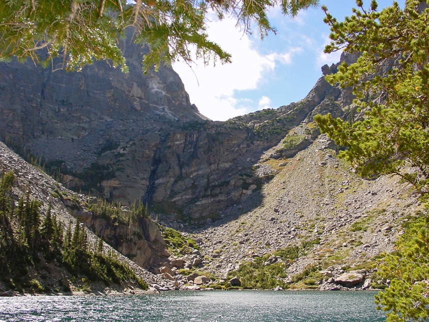
Emerald Lake, Colorado
Emerald Lake, Rocky Mountain National Park · Frans-Banja Mulder · Photo source · CC BY 3.0 Wikimedia thumbnail converted to JPEG; no crop
5.8 km; ascent reference approximately 184 m (measurement basis below); 2–3 hours; Moderate. Recommended months: 7–9. Start at Bear Lake via Nymph and Dream lakes. NPS lists 2.9 km each way and 184 m gain without separately quantifying reverse undulations. Use Bear Lake parking or seasonal shuttle; Timed Entry+ applies May 22–October 18, 2026, 5 am–6 pm, plus park admission. The October 8 report was mostly dry, not a guarantee of ice-free conditions today.
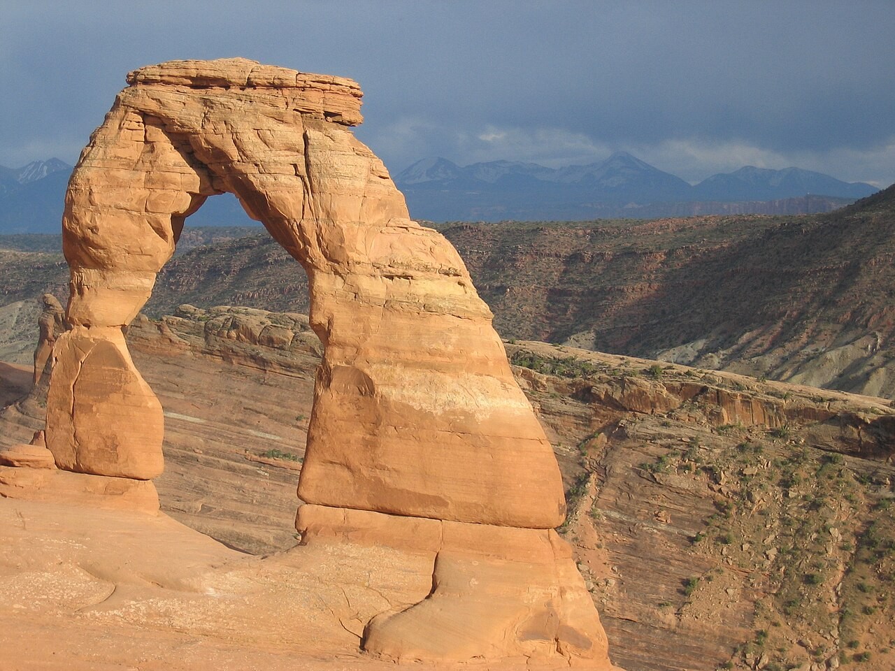
Delicate Arch, Arches National Park · “Jon Zander (Digon3)” · Photo source · CC BY-SA 3.0 Wikimedia thumbnail converted to JPEG; no crop
4.8 km; ascent reference approximately 146 m (measurement basis below); 2–3 hours; Strenuous and exposed to sun. Recommended months: 3–5, 9–10. Start at Wolfe Ranch and return from the close-up viewpoint; this is not the short distant Lower Viewpoint walk. Arches does not require advance timed entry in 2026, but admission applies and congestion can temporarily stop entry. Carry water and stay back from steep slopes; do not climb the arch.
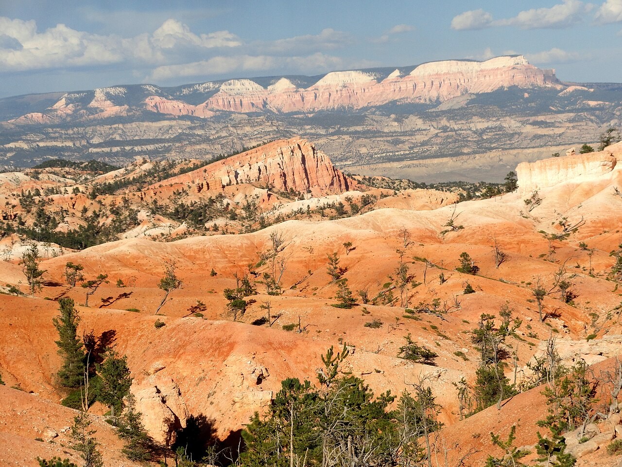
View from Queen’s Garden Trail, Bryce Canyon · Fabio Achilli from Milano, Italy · Photo source · CC BY 2.0 Wikimedia thumbnail converted to JPEG; no crop
4.6 km; ascent reference approximately 191 m (measurement basis below); 2–3 hours; Moderate. Recommended months: 5–10. Descend Queen’s Garden from Sunrise, climb Two Bridges to Sunset and return on the Rim Trail. NPS explicitly lists 191 m total ascent. Seasonal shuttles serve the rim; no separate hiking reservation, park admission applies. This route uses Two Bridges, avoiding the seasonally closed Wall Street branch. Pace for altitude and avoid thunderstorms.
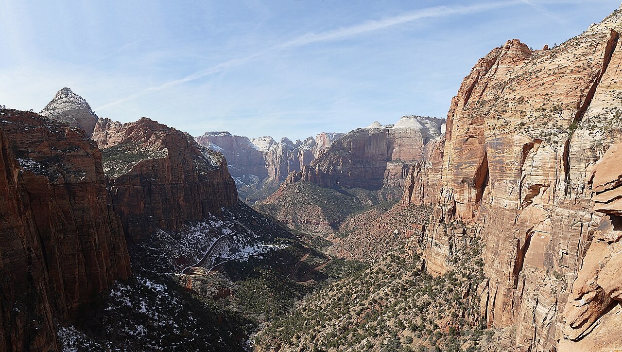
Zion Canyon viewed from Canyon Overlook; image includes patchy snow and is not a current conditions report · Óðinn · Photo source · CC BY-SA 2.5 ca Wikimedia thumbnail converted to JPEG; no crop
1.6 km; ascent reference approximately 50 m (measurement basis below); 1 hours; Moderate, exposed edges. Recommended months: 3–5, 9–10. Start beside the east tunnel portal. The official 50 m figure is elevation change, not a separately measured GPS cumulative total. Canyon shuttles do not stop here and parking is very limited. No Angels Landing permit is needed; park admission applies. Uneven rock and partly protected drop-offs demand care; skip in ice or if uncomfortable with heights.
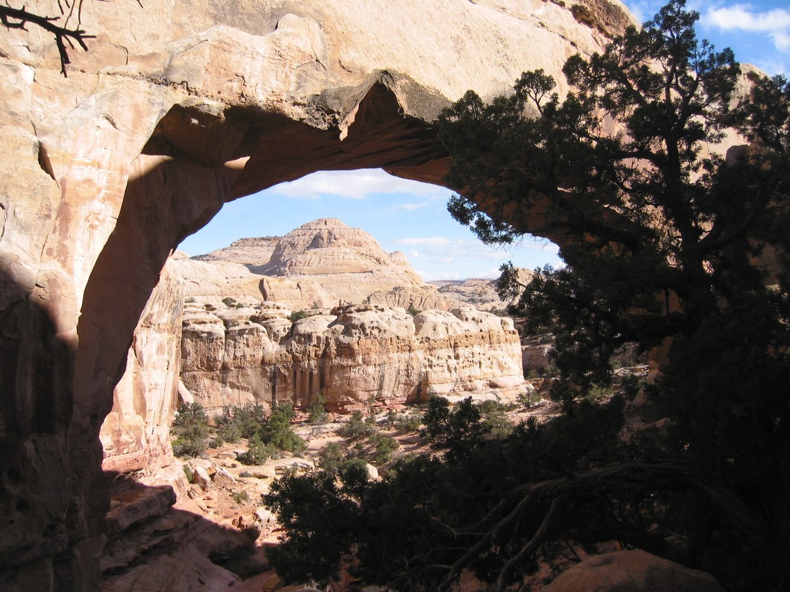
Hickman Bridge, Capitol Reef National Park · Bob Palin · Photo source · CC BY-SA 2.0 Wikimedia thumbnail converted to JPEG; no crop
2.8 km; ascent reference approximately 122 m (measurement basis below); 1.5–2 hours; Moderate. Recommended months: 4–5, 9–10. Follow the UT-24 trailhead to the natural bridge and return. NPS lists 1.4 km each way and 122 m elevation change, without a separate cumulative total. Day hiking does not require an overnight wilderness permit; check fees if entering the Scenic Drive area. On October 15 Scenic Drive was 2WD-accessible but Capitol Gorge road closed and many remote tracks likely impassable; those roads are excluded.
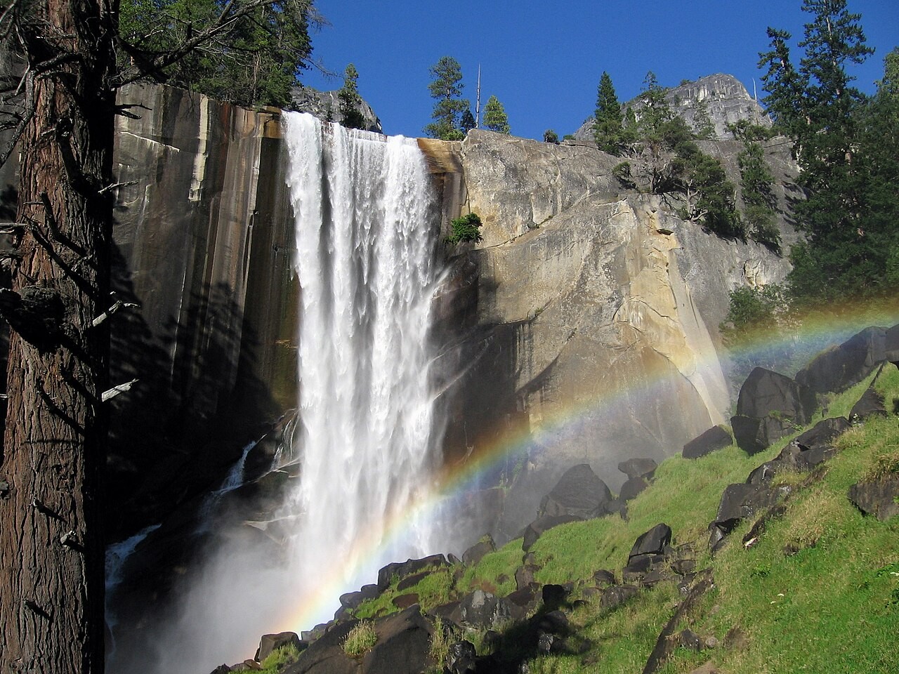
Vernal Fall and rainbow, Yosemite National Park · God of War · Photo source · CC BY-SA 3.0 Wikimedia thumbnail converted to JPEG; no crop
3.9 km; ascent reference approximately 300 m (measurement basis below); 3 hours; Strenuous, slippery steps. Recommended months: 5–9. Start at Happy Isles shuttle stop 16; Nevada Fall and Half Dome are excluded. July 27–October 2026 works close the direct section Monday–Thursday 7 am–3:30 pm; follow the John Muir detour when required, whose length is not the 3.9 km figure. This distance applies only when the direct route is open. Admission applies; never swim near falls or cross railings.
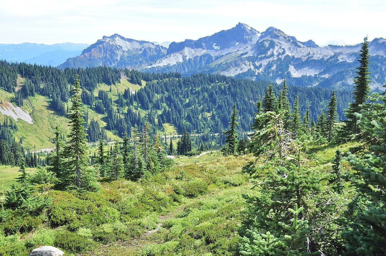
Looking southeast from Skyline Trail, Mount Rainier National Park; not a view of the Rainier summit · Joe Mabel · Photo source · CC BY 4.0 Wikimedia thumbnail converted to JPEG; no crop
8.9 km; ascent reference approximately 518 m (measurement basis below); 4.5 hours; Moderate to strenuous. Recommended months: late July–9. Start at the Paradise visitor-center steps and follow the clockwise loop via Panorama Point and High Skyline, avoiding the dangerous icy slope. NPS’s 5.5 miles / 1,700 ft convert to about 8.9 km / 518 m. Complete the loop only in suitable snow-free conditions; October–June usually involves snow travel. Park admission applies, no day-use-area camping, and no Camp Muir extension.
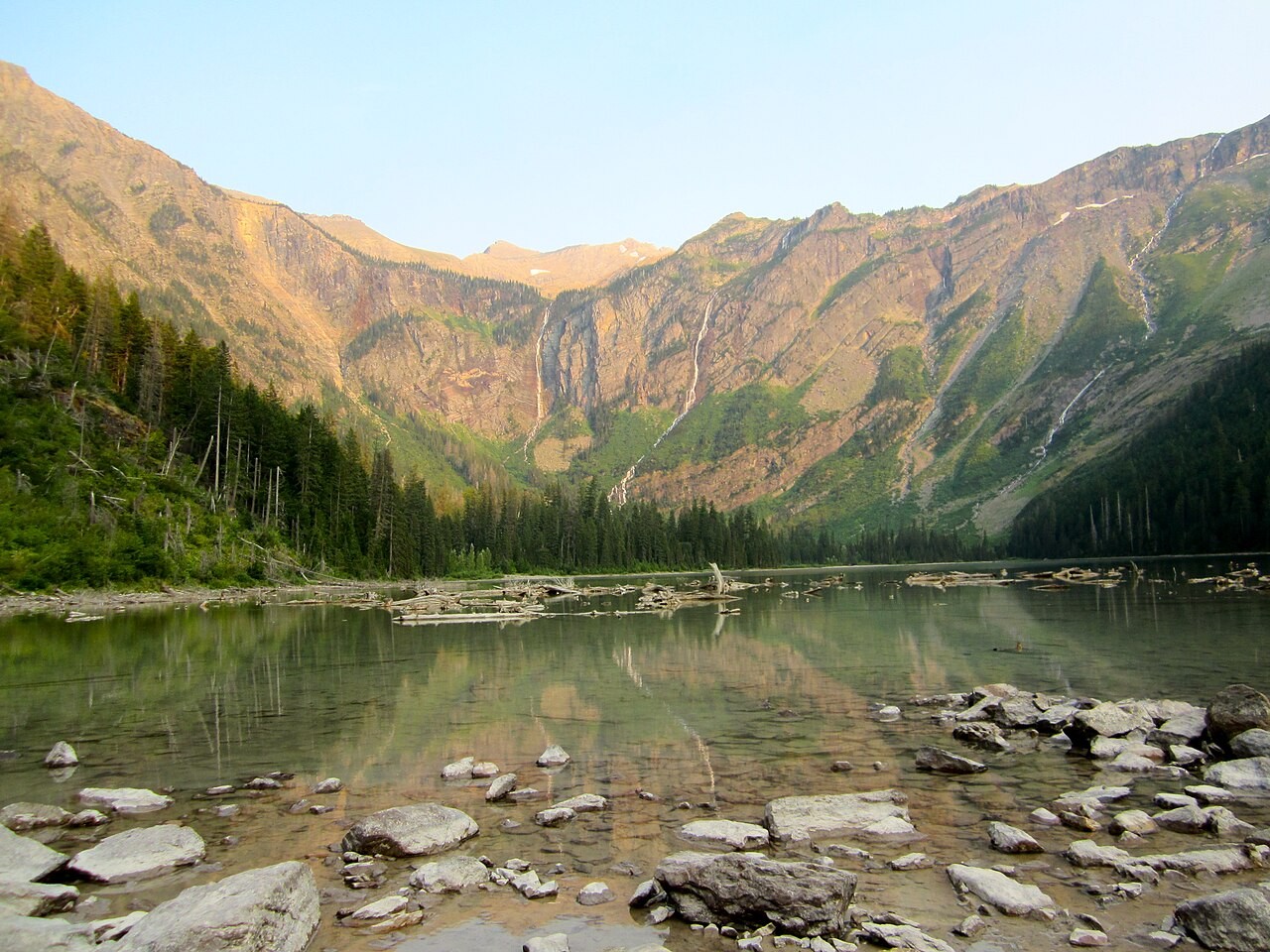
Avalanche Lake, Glacier National Park · Beatlesnature · Photo source · CC BY-SA 3.0 Wikimedia thumbnail converted to JPEG; no crop
7.4 km; ascent reference approximately 310 m (measurement basis below); 3–4 hours; Moderate. Recommended months: 6–9. NPS lists 3.7 km one way from Avalanche Picnic Area with 226 m gain and 84 m loss; return ascent is calculated as about 310 m. Other parking starts or lakeshore extensions change the distance. Connect via Trail of the Cedars and check Going-to-the-Sun Road and seasonal shuttle access. Admission applies; hike bear-aware in a group and keep away from swift water. Recheck the trail report before departure.
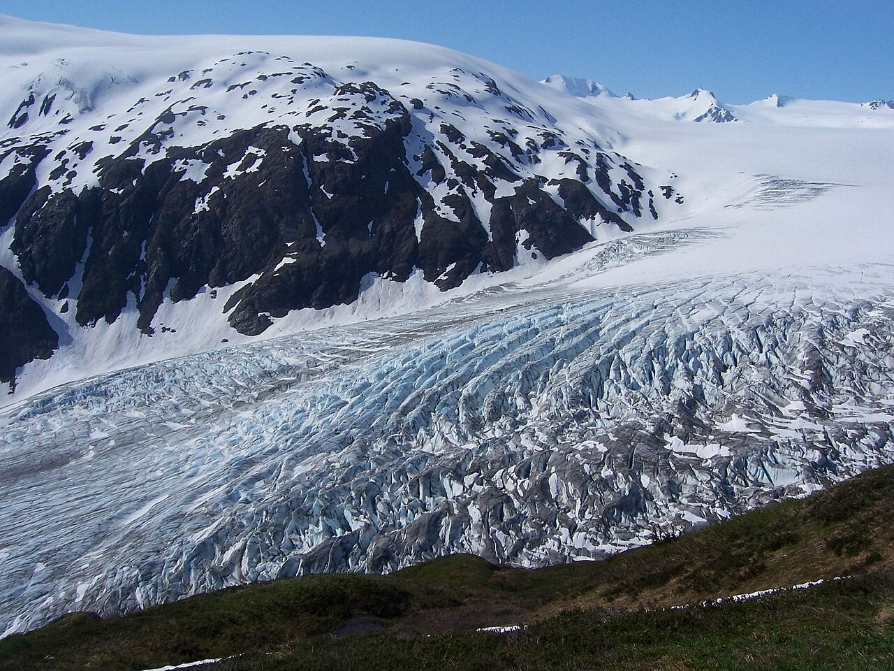
Exit Glacier viewed from Harding Icefield Trail; no glacier walking is included · Justin Morgan from Richmond, Virginia, USA · Photo source · CC BY-SA 2.0 Wikimedia thumbnail converted to JPEG; no crop
13.2 km; ascent reference approximately 1067 m (measurement basis below); 6–8 hours; Strenuous. Recommended months: late July–8. Use the 8.2-mile return distance from the Nature Center. The NPS activity page reports about 3,500 ft / 1,067 m ascent; a separate 7.8-mile figure starts at the trail register and should not be mixed. Exit Glacier Road is seasonal; park entry is free. The September 8 report still noted snow patches and is not live October confirmation. Stay on land, off the glacier and out of the closed outburst-flood canyon.
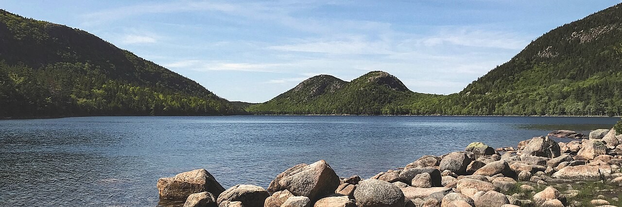
Jordan Pond and the Bubbles, Acadia National Park · NPS / Victoria Stauffenberg
derivative work: User:Maps and stuff (cropped to 3:1 ratio, mostly from top and bottom; reduced saturation slightly; brightened dark areas) · Photo source · Public domain Wikimedia thumbnail converted to JPEG; no crop
5.3 km; ascent reference approximately 9 m (measurement basis below); 1–3 hours; Relatively level, rocky and boardwalk sections. Recommended months: 6–10. NPS gives a 3.3-mile loop and 28 ft, about 9 m, gain/loss: an approximate park figure, not an accessibility guarantee or a count of every step over boulders. Start on the east shore; the west has rocks and narrow slippery boardwalks. Turn back along the east if needed. Use Jordan Pond House parking or seasonal Island Explorer; no trail booking, park admission applies, and swimming is prohibited in the drinking-water source.
For readers who want to compare landscapes before choosing one region. Even short trails can have exposed edges, wet steps or high altitude; distance alone does not define difficulty.
When to go and what to pack
Utah lowlands are more comfortable in spring and fall; summer can exceed 38°C. High-elevation Bryce can freeze on shoulder-season mornings. Alpine summer still brings storms and snow: carry rain protection, warm layers, sun protection and grippy footwear. Months describe typical planning windows, not a forecast.
Two complete itineraries
Choose one complete itinerary below. Suggested local times allow for meals and breaks; swap days around opening calendars and dated reservations.
Collect a standard rental car and drive roughly 260 km / 2.5–3 hours via I-15 and UT-9, allowing for the time-zone change. Stay two nights in Springdale, buy water and lunch supplies and keep the afternoon light. Confirm shuttles and weather.
Day 2 | Zion Canyon Overlook
Drive roughly 10–15 km / 20–30 minutes each way toward the east tunnel portal, plus traffic and parking time. Do the 1.6 km return only with legal parking and suitable weather. Rest midday; an optional canyon shuttle sightseeing ride adds no Narrows wading or Angels Landing climb.
Day 3 | Zion to Bryce
Allow about 140 km / 2–2.5 hours to Bryce City after checking UT-9. Stay one night. Allow 2–3 hours plus uphill breaks for the 4.6 km Queen’s/Navajo loop in suitable conditions; use rim viewpoints instead if storms or fatigue make the descent unwise.
Day 4 | Return to Las Vegas
Drive roughly 420 km / 4–4.5 hours, adding breaks, fuel, car return and airport time. Do not add a long canyon hike before departure.
Deeper stay · 7 days / 6 nights
Day 1 | Las Vegas to Springdale
Collect a standard rental car and drive roughly 260 km / 2.5–3 hours via I-15 and UT-9, allowing for the time-zone change. Stay two nights in Springdale, buy water and lunch supplies and keep the afternoon light. Confirm shuttles and weather.
Day 2 | Zion Canyon Overlook
Drive roughly 10–15 km / 20–30 minutes each way toward the east tunnel portal, plus traffic and parking time. Do the 1.6 km return only with legal parking and suitable weather. Rest midday; an optional canyon shuttle sightseeing ride adds no Narrows wading or Angels Landing climb.
Day 3 | An easy transfer to Bryce
Drive about 140 km / 2–2.5 hours and stay two nights in Bryce City. Keep the afternoon to rim viewpoints and the visitor center, allowing altitude adjustment before tomorrow’s hike.
Day 4 | Queen’s/Navajo loop
Walk the 4.6 km loop during a stable weather window, taking the uphill slowly with food and water. Rest afterward. Use this day flexibly if weather disrupted plans rather than adding another strenuous route.
Day 5 | UT-12 to Torrey
Follow paved UT-12 via Escalante and Boulder, about 180 km / 2.5–3 hours driving; allow much of the day with lunch and viewpoints. Stay two nights in Torrey. Do not divert onto Burr Trail, Notom-Bullfrog or canyon tracks; check UDOT in rain or snow.
Day 6 | Hickman Bridge and recovery
Drive roughly 20 km / 20 minutes each way to the UT-24 trailhead and allow 1.5–2 hours for the 2.8 km return hike. Spend the afternoon gently around Fruita; exclude closed Capitol Gorge and potentially impassable Cathedral Valley roads.
Day 7 | Finish in Salt Lake City
Allow roughly 350 km / 3.5–4 hours driving plus breaks and car return. Confirm the one-way rental charge in advance: this itinerary starts in Las Vegas and ends in Salt Lake City, not a same-city rental.
Getting around and where to stay
Choose one region before booking lodging and park transport. The itineraries use paved roads and exclude slot-canyon wading, glacier travel and technical mountaineering. Zion Canyon shuttles do not serve Canyon Overlook; its tiny parking areas may require trying another time. In 2026 non-US residents aged 16+ pay an additional USD100 each at 11 parks including Zion, Bryce, Acadia, Glacier, Rocky Mountain and Yosemite unless covered by a valid pass. The budget allocates USD125 per person assuming two adults travel in the same vehicle with an eligible nonresident annual pass; this is a shared allocation, not an individual ticket price. Passes do not replace reservations, parking or campsite charges.
Optional travel tools
Use established open trails. View icefields from land without stepping onto glaciers; Angels Landing, Half Dome and cliff-edge posing are excluded.
Car rental option
We may earn a commission when you book through our affiliate links, at no extra cost to you.
A | Families: choose for the least experienced walker and start short; Canyon Overlook and Mist Trail are unsuitable for toddlers who may run toward edges.
B | Couples: agree on turnaround points and keep the rest day flexible.
C | Pets: most listed national-park trails prohibit pets; Jordan Pond permits a leash no longer than six feet.
D · Separate per-person budgets
Every figure below is a per-person, full-trip USD planning allowance, not a live quote. Room costs assume equal sharing with one companion; solo travellers replace that share with their full room cost. Shared transport uses the same split where stated; per-person tickets and experiences are not divided again. International flights, visas, insurance and shopping are excluded. Replace with tax-inclusive quotes and deduct meals/admission already included in an experience. CAD uses an illustrative 1 USD = 1.40 CAD, not a live exchange rate. The PDF contains static examples; the two website calculators can be edited independently.
Short stay · 4 days / 3 nights
D | Static per-person plan USD885/CAD1239, using an illustrative 1USD=1.40CAD, not a live exchange rate or quote. 3 nights at USD100 per person/night assuming two adults share a room. USD200 transport includes this person’s rental insurance, fuel and parking allocation; shared items split equally, with one-way-rental allowance in the longer trip. USD125 park cost is a two-person same-vehicle pass allocation, not a halving of the individual USD100 nonresident surcharge; any applicable individual fee is paid in full. Food USD180, contingency USD80; flights, travel insurance and equipment excluded.
Per-person allowance
USD
CAD × 1.40
Accommodation
300.00
420.00
Meals
180.00
252.00
Local transport / transfers
200.00
280.00
Selected experience allowance
0.00
0.00
Other admission / extras
125.00
175.00
Reserve
80.00
112.00
Total per person
885.00
1,239.00
Deeper stay · 7 days / 6 nights
D | Static per-person plan USD1550/CAD2170, using an illustrative 1USD=1.40CAD, not a live exchange rate or quote. 6 nights at USD100 per person/night assuming two adults share a room. USD380 transport includes this person’s rental insurance, fuel and parking allocation; shared items split equally, with one-way-rental allowance in the longer trip. USD125 park cost is a two-person same-vehicle pass allocation, not a halving of the individual USD100 nonresident surcharge; any applicable individual fee is paid in full. Food USD315, contingency USD130; flights, travel insurance and equipment excluded.
Per-person allowance
USD
CAD × 1.40
Accommodation
600.00
840.00
Meals
315.00
441.00
Local transport / transfers
380.00
532.00
Selected experience allowance
0.00
0.00
Other admission / extras
125.00
175.00
Reserve
130.00
182.00
Total per person
1,550.00
2,170.00
For a lower-cost trip, choose the independent route and remove the optional guided-experience allowance. For extra comfort, raise the room or transfer allowance. Choose the short OR long budget; do not add both totals.
Before departure
Canada’s US advisory checked 2026-10-15 says take normal security precautions; these routes avoid the Mexican border. Confirm entry eligibility and medical coverage. Weather, rockfall, wildlife and heat remain hazards. Do not bypass closures or assume a summer trail is suitable in winter.
Check opening calendars, strikes or closures, and dated ticket inventory again shortly before travelling. This evergreen route makes no claim that a future festival is scheduled or on sale.
READER OFFER · 10% OFF
Saily travel eSIM · 10% off
Stay connected for maps, transport and travel plans. Compare coverage, data allowance, validity, activation rules and unlocked-device compatibility before buying.
This link includes the coupon for automatic application. If it is not shown at checkout, enter HAPPYTOGETHER manually.
Applies to new purchases across all Saily plans and destinations. No expiry date has been set. Combining this code with other promotions has not been confirmed; check the discount and final total at checkout.
Affiliate disclosure: Happy Together Trips may earn a commission on eligible purchases through this link, at no extra cost to you.
Selection evidence and sources
Two independent creator samples illustrate interest in US national-park hiking, not a global ranking. Direct video retrieval was restricted; counts are indexed snapshots, and Instagram post metrics were unverified. This national list is independently edited for landscape and effort, not copied from a video ranking.
Research checked 15 October 2026. YouTube figures below are search-index snapshots, not live counters; publication dates and missing fields are shown as available. Videos were not copied or treated as a platform ranking. Instagram access and any missing or conflicting fields are described beside each source; unavailable metrics are excluded from quantitative comparisons. Only accessible public metadata was reviewed, not entire video content. Sources have different periods and measures; they are not a cross-city league table.
Dirt In My Shoes Published 2025-01-27; indexed snapshot checked 2026-10-15: 13,369 views / 420 likes.
Through My Lens Published 2025-08-24; indexed snapshot checked 2026-10-15: 117,759 views / 2,900 likes.